
Complexity of the Book of Mormon
Direct quote from “Curiously Unique: Joseph Smith as Author of the Book of Mormon” by Brian C. Hales, Interpreter: A Journal of Latter-day Saint Faith and Scholarship 31 (2019):
Begin Quote
The complexity of the Book of Mormon can be assessed through general observations, as well as technical measurements. The text mentions the activities of more than 175 individuals and groups who existed in at least 125 different topographical locations.
Found within the narrative are 337 proper names, of which 188 are unique to the Book of Mormon. The chapters reference more than 425 specific geographical movements.
Also included are 430 identifiable chiasms, with more than thirty being six-level or greater. Throughout the Book of Mormon Joseph Smith used more than 100 different names for deity.
End Quote
Given the complexity of the 425 specific geographical movements that are in the Book of Mormon, it seems that an approach to discover the book’s major city may yield a better result than trying to understand the interconnections of hundreds of geographical points.
The events of the Book of Mormon took place over about one thousand years and in an area of more than a billion acres. By far, Zarahemla is the most frequently mentioned place name in the Book of Mormon. By focusing on 7,000 acres in Lee County, Iowa, as the likely location for the Lost City of Zarahemla, the research will be confined to less than one-thousandth of a percent of the total area found within the geography of the ancient people in the Book of Mormon. Just as the city of Rome occupied a small space in the entire area of the Roman Empire, so, Zarahemla was in a little place in the total geographical area of the Book of Mormon. Also, like Rome, Zarahemla was a vital place tying together as much as one million square miles of territory. For hundreds of years, Zarahemla was the center of government, military, and trade. These facts confirm the idea that if anyone can find the location of Zarahemla, it would become an essential geographical site for the historicity of the Book of Mormon.
John Lefgren PhD will show you in a short 6 minute video below about the importance of finding ancient fires. Heartland Research Group has already sent the first 25 core samples to a professional laboratory to carbon date the fire pits found all over the Nauvoo, Illinois and Montrose, Iowa area, which will prove habitation during the Nephite times.
-0001.png/:/rs=w:400,cg:true,m) SENSYS Technology successfully locates roundhouses in Ohio that are 2,000 years old. 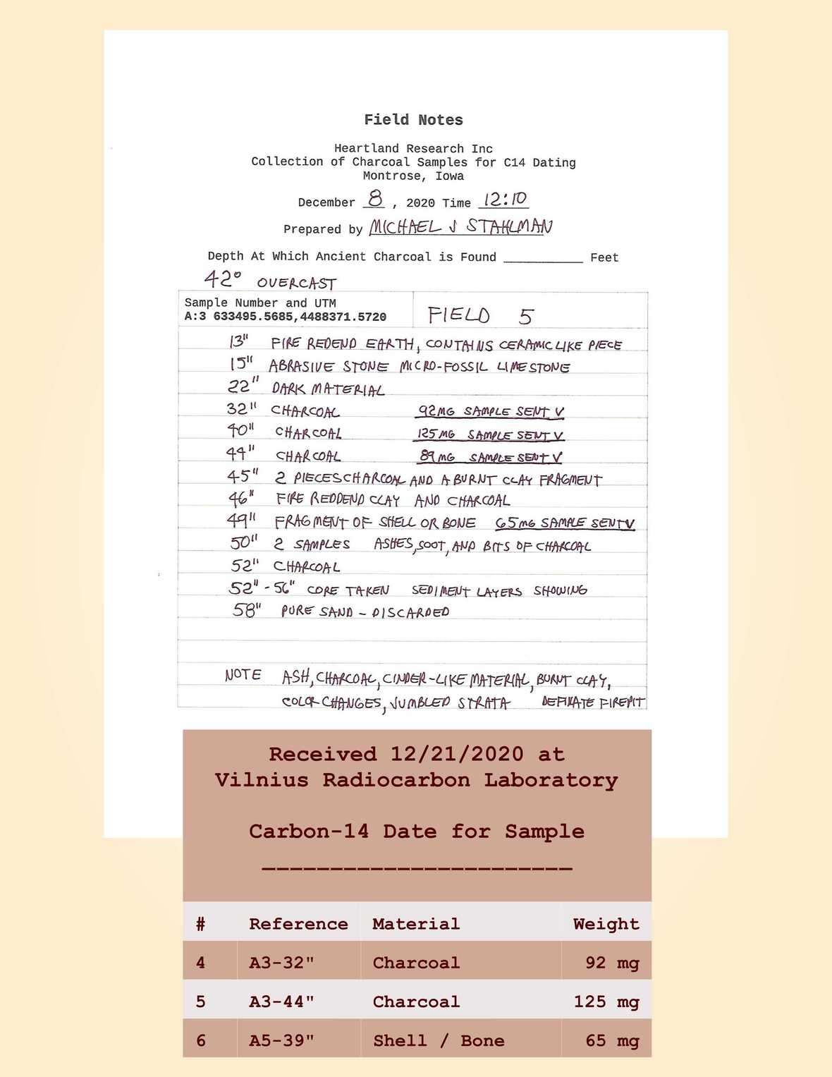 Field Report from Mike and Rhonda Stalhman. Field Report from Mike and Rhonda Stalhman. On December 8th, 2020, at 7:45 a.m., Wayne May, Michael, and Rhonda Stahlman, met at a Lee County administered survey benchmark; just north of Montrose Iowa near the intersection of Highway 61 and 280th St. Using this established point as a control reference, the G.P.S. Locating equipment was tested for operation. The equipment consisted of a Pro Mark 700 G NS 5 receiver, the antenna used to connect to the Iowa real-time network. This is a network of 82 base units joined together to provide coverage for the entire state of Iowa. Set up and administered by the Iowa Department of Transportation with the cooperation of the Iowa State University, this GPS system is available to anyone that subscribes to the service. It’s used mainly by farmers and construction companies; the subscription is for two years and is provided at no cost. It works through civilian cell phone networks and is effective wherever there is cell phone coverage and provides accuracy measured in millimeters. Fortunately, there is good coverage in Montrose Iowa. Being able to use the Iowa RTK saved us the expense of having to buy a base. These can cost up to $50,000.The rest of the equipment included a Carlson’s Surveyor II, the data collector and its associated software, and a carbon fiber leveling pole to support everything. These components are collectively known as a rover. After adjusting the input and getting the unit to recognize the proper coordinate system, we headed to what is being referred to as field five. There we were met by Scott Wilson and David Faria around 10:30 AM. After outlining our plans we went to work. We first located the pre-picked target with the Rover, which had been pre-loaded with the GPS co-ordinates of the intended targets. Each target in a grouping was flagged and staked with its ID number. Following immediately behind the Rover, one of the crew members went to work with post hole diggers, excavating to approximately 16” to get through the plow zone. Any material in this zone is considered unfit for testing due to disturbance from agriculture. Coming along behind the post hole digger came a hand-operated 3 1/2 diameter, stainless steel auger. The auger could remove around 6 – 8 inches of material with each “bite”. Each “bite” of the material was emptied into a plastic tub. Using margin trowels to remove the material from the auger cup. The material was closely inspected for any signs of fire, ash, or charcoal. Any charcoal or unusual material was placed, using the margin trowel into a quart-sized zip-locked bag which was marked with the target location index designation as well as the depth that it was recovered from. Each sample and depth was also recorded in the field notebook. Each sample is identified by the index number for the target and the depth it was recovered. The field notes mention what the sample appears to be. For example, our first piece of charcoal, from target A1 at the depth of 48” is A1-48, and so forth. We recovered our first piece of charcoal 48” down on the first target we augured. We then switched to a 2” diameter split sleeve sampler with a plastic liner sleeve. We took a 6” core sample from a depth of 49- 55”. Using this method we moved through all five targets in the first grouping of field five, everyone taking turns on the auger. We were visited at this point by the landowner. We loaded the equipment and moved on to the next grouping of targets. (Targets 6-9) and repeated the process. On Wednesday, December 9th, the members of the group met at field 1 and repeated the process of the previous day on targets A19, 20, 21, and 22. We had John Lefgren send us the coordinates of an additional target designated as target A30. We tested it as well, going down 92”. At this point, we decided to return to field 5 and continue testing there. We did targets A12 through A15 before moving on to the pair at A10 and A11. After lunch, Mike and Rhonda Stahlman and Wayne May moved on to field 9. Scott Willis and Dave Faria left to begin their trip home. We had John Lefgren send us the co-ordinates for 2 more targets designated as A31 and A32. We repeated the process on targets 28, 23, 24, and 32. Target 32 was left unfinished due to the setting of the sun. Mike and Rhonda Stahlman wanted to take advantage of the good weather on Thursday, December 10th and test drill the remaining targets. After Wayne May had Jeff Miller temporarily repair the fuel line on his car he left to return home. Rhonda and I returned to field 9 and completed target A32 going a terminal depth of 106”. We then did targets A31, 27, 25, and 26.  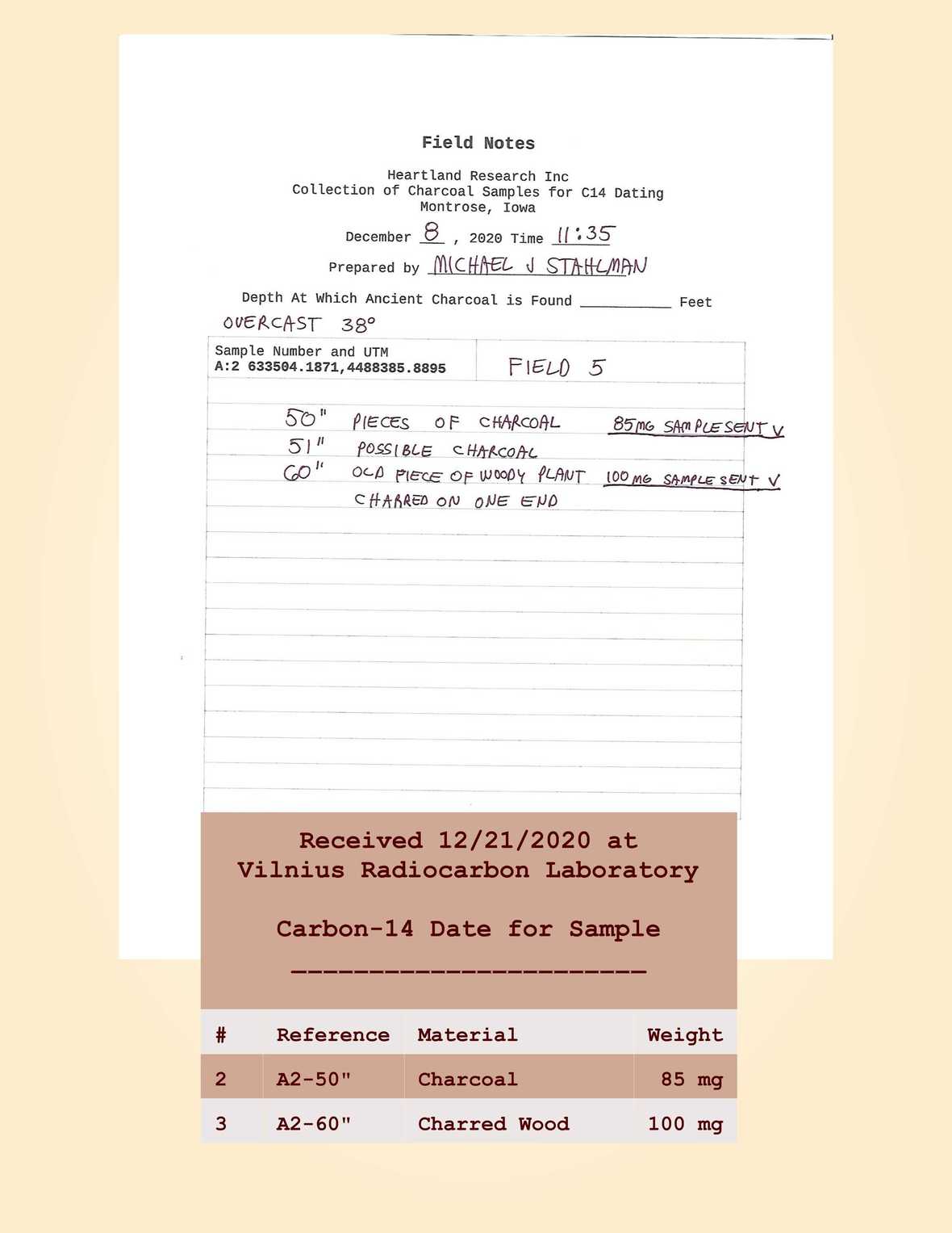 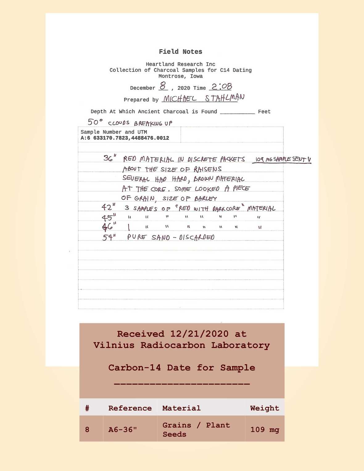 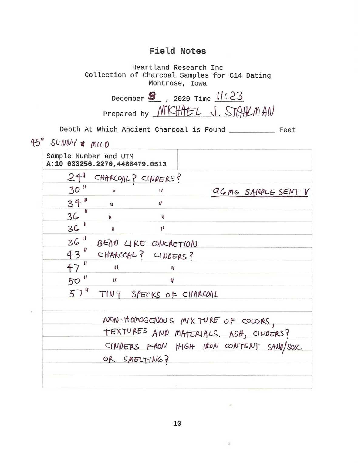 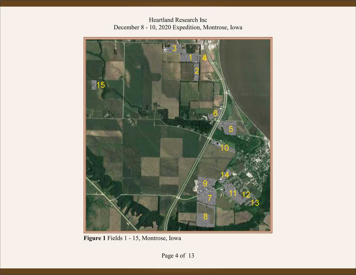 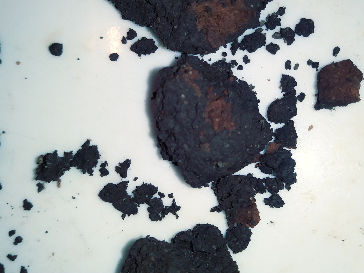 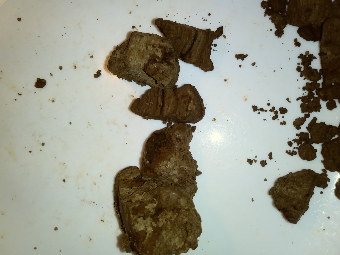 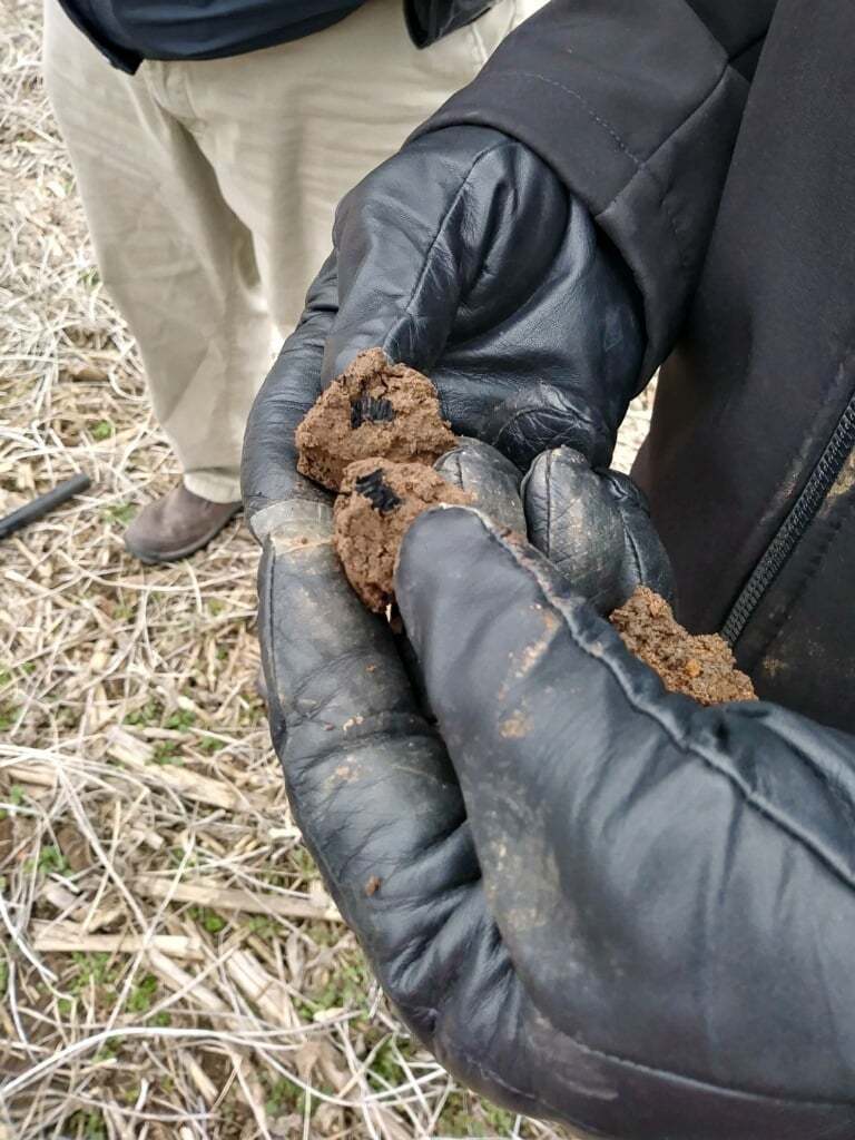 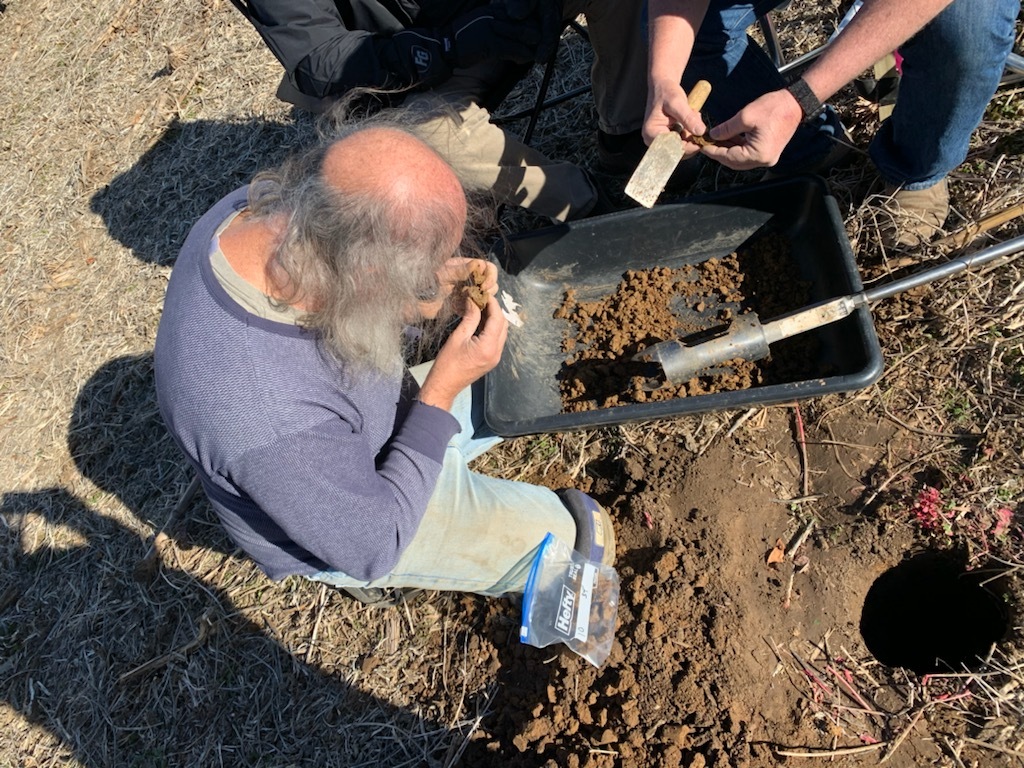 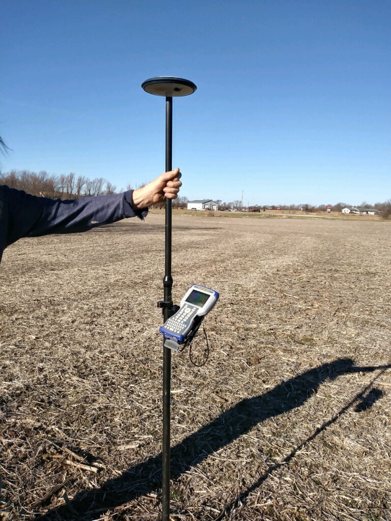 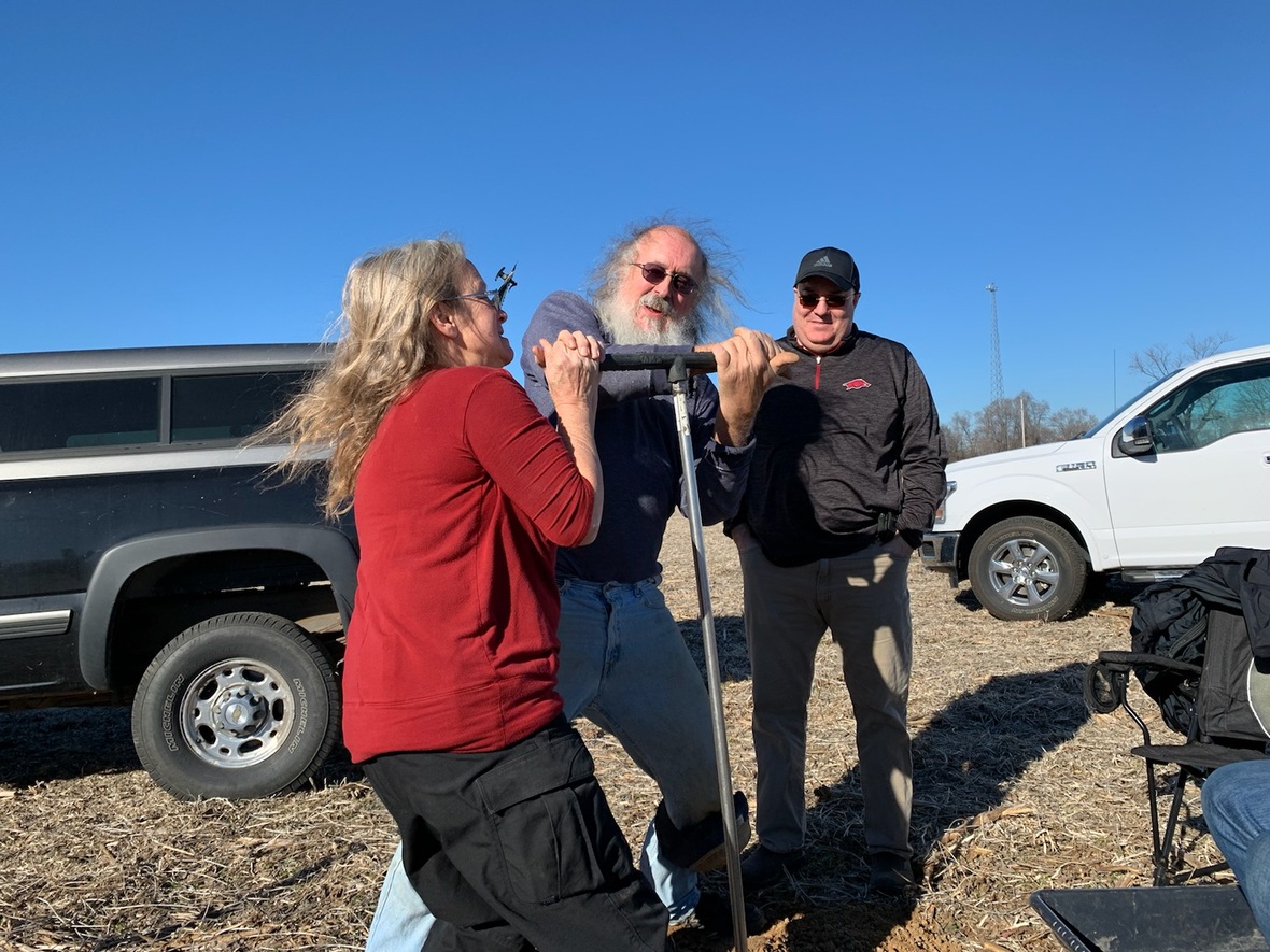 Donate Now 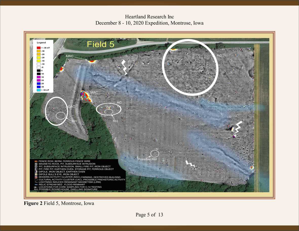 ©2020 Heartland Research Inc | 2681 Milan Street ©2020 Heartland Research Inc | 2681 Milan Street |