
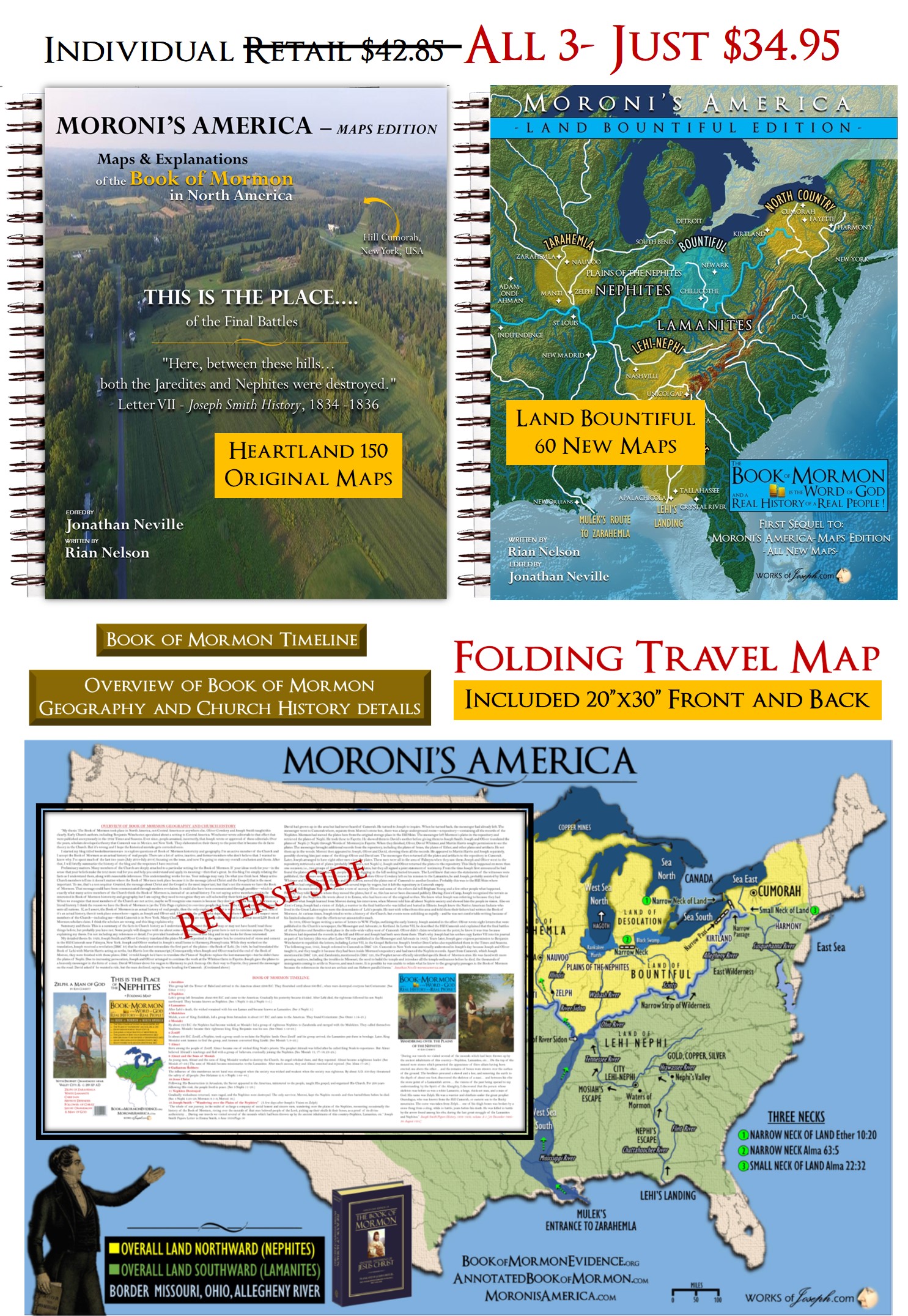
A Heartland Believer
I believe the Book of Mormon Events began in North America as many prophets and leaders have taught. There are Lamanites in North, South, and Central America through migration, intermarriage and other circumstances. However, through much study and prayer it makes most sense to me that Lehi landed in Florida and Nephi leaving his brethren, ended up in northern Georgia and Tennessee. Mosiah left and went to Iowa and Illinois to join the Mulekites who were already in those areas. Knowing this is important to me as Moroni has said “ye may know the truth of all things.” I have received many personal answers to questions of secondary importance to my spiritual confirmation that the Book of Mormon is true and Joseph translated it using the Interpreters as he said in JSH 1:35, and not by using a silly, in my opinion, stone in a hat. I agree with Joseph Fielding Smith’s wonderful information below. I caution the reader when Elder Smith says, some may be “greatly disturbed in their faith”, quoted below.
Today I discuss more information about location of artifacts that show earlier civilizations here in North America. I love the New York area and today I speak about Lamoka Lake in Tyrone, NY. It is fascinating. I call the New York tribes, “Joseph Smith’s Lamanites” as he lived near them and was taught by many of them in his city and county.
Joseph Fielding Smith” said,
“LOCALE OF CUMORAH, RAMAH, AND RIPLIANCUM. This modernistic theory of necessity, in order to be consistent, must place the waters of Ripliancum and the Hill Cumorah some place within the restricted territory of Central America, notwithstanding the teachings of the Church to the contrary for upwards of 100 years. Because of this theory some members of the Church have become confused and greatly disturbed in their faith in the Book of Mormon. It is for this reason that evidence is here presented to show that it is not only possible that these places could be located as the Church has held during the past century, but that in very deed such is the case.
It is known that the Hill Cumorah where the Nephites were destroyed is the hill where the Jaredites were also destroyed. This hill was known to the Jaredites as Ramah. It was approximately near to the waters of Ripliancum, which the Book of Ether says, “by interpretation, is large, or to exceed all.”233. 18 Mormon adds: “And it came to pass that we did march forth to the land of Cumorah, and we did pitch our tents round about the hill Cumorah; and it was in a land of many waters, rivers, and fountains; and here we had hope to gain advantage over the Lamanites.” 233. 19…
“In the Book of Mormon story the Lamanites were constantly crowding the Nephites back towards the north and east. If the battles in which Zelph took part were fought in the country traversed by the Zion’s Camp, then we have every reason to believe from what is written in the Book of Mormon, that the Nephites were forced farther and farther to the north and east until they found themselves in the land of Ripliancum, which both Ether and Mormon declare to us was the land of Ramah or Cumorah, a land of “many waters,” which “by interpretation, is large, or to exceed all. ” 240. 32…
Mesoamerican Quote
Considering the quote above by Elder Smith, the following quote seems very out of place to me. “There remain Latter-day Saints who insist that the final destruction of the Nephites took place in New York, but any such idea is manifestly absurd. Hundreds of thousands of Nephites traipsing across the Mississippi Valley to New York, pursued (why?) by hundreds of thousands of Lamanites, is a scenario worthy only of a witless sci-fi movie, not of history.” John L. Sorenson, Mormon’s Codex (Deseret Book, 2013), p. 688.
I am one of those “Latter-day Saints who insist that the final destruction of the Nephites took place in New York“, as brother Sorensen says. We are all free to chose our own position as our Church has no doctrine on the subject, but I just believe the Heartland setting makes most sense to me.
Waters of Ripliancum, which, by Interpretation, is Large, or to Exceed All;
“RIPLIANCUM. Supposed by some to be lake Ontario, but evidently one of that great chain of lakes. Its meaning is said to be, “large, or to exceed all,” (Ether, 15:8.) Near its waters the opposing Jaredite armies, commanded by Coriantumr and Shiz, camped, and afterwards fought an exceedingly sore battle, in which the latter was defeated and driven southward towards the hill Ramah, or Cumorah.” Dictionary of the Book of Mormon
I would not say as above, “supposed by some“, but that I feel strongly Ripliancum is Lake Ontario. We also know this Hill Ramah for the Jaredites is the exact same hill for the Nephites who called it Hill Cumorah and in Ether 15:11, it says, “the hill Ramah; and it was that same hill where my father Mormon did up the records unto the Lord, which were sacred.”
More Joseph Fielding Smith
Joseph Fielding Smith Continues, “This being true, what would be more natural then that Moroni, like his father Mormon, would deposit the plates in the land where the battles came to an end and the Nephites were destroyed? This Moroni says he did, and from all the evidence in the Book of Mormon, augmented by the testimony of the Prophet Joseph Smith, these final battles took place in the territory known as the United States and in the neighborhood of the Great Lakes and hills of Western New York. And here Moroni found the resting place for the sacred instruments which had been committed to his care. 241. 33″ Joseph Fielding Smith Doctrines of Salvation Volume 3 Chapter 12 A VOICE FROM CUMORAH Page 589-599 Compiled by Bruce R. McConkie 1954-56
What are the Finger Lakes?
The Finger Lakes are a group of eleven lakes in upstate New York, United States, named for their long, narrow shape. They consist of Otisco Lake, Skaneateles Lake, Owasco Lake, Cayuga Lake, Seneca Lake, Keuka Lake, Canandaigua Lake, Honeoye Lake, Canadice Lake, Hemlock Lake, and Conesus Lake. https://www.worldatlas.com/lakes/what-are-the-finger-lakes.html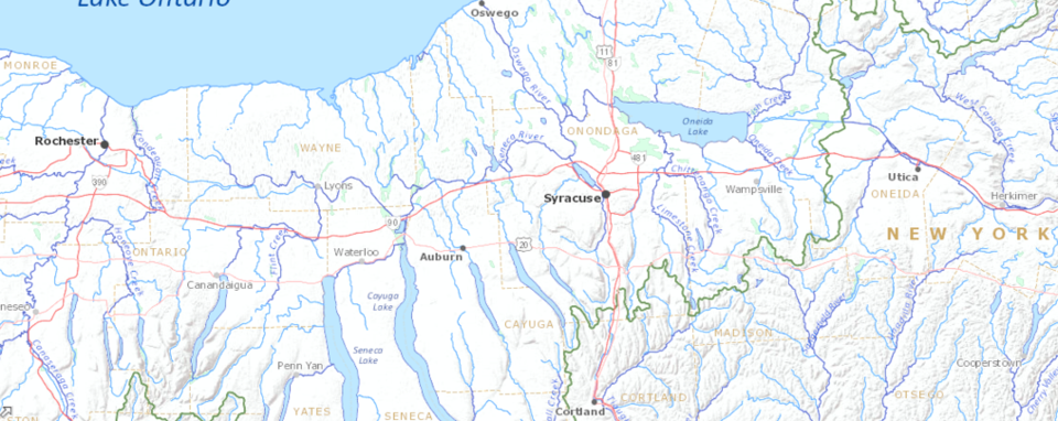
Artifacts at the Finger Lakes
A Facebook friend named Richard Hardesty sent me this article. It is fantastic information all about the range of time of the Native Americans during the Jaredite period of 3500 BC to Fort Stanwix or Historical Natives in the 1600 AD time, in the area of the Finger Lakes of New York. I love this “North Country” as Moroni called it [Ether 1:1] and as Mormon said, “And it came to pass that we did march forth to the land of Cumorah, and we did pitch our tents around about the hill Cumorah; and it was in a land of many waters, rivers, and fountains; as the Book of Mormon describes.” Mormon 6:4
This language of Prophets describes the Great Lakes and Finger Lakes area precisely, especially with Mormon also calling it the Land of Cumorah. I love New York area as I also call it the area of “Joseph Smith’s Lamanites.” [Blog Here]
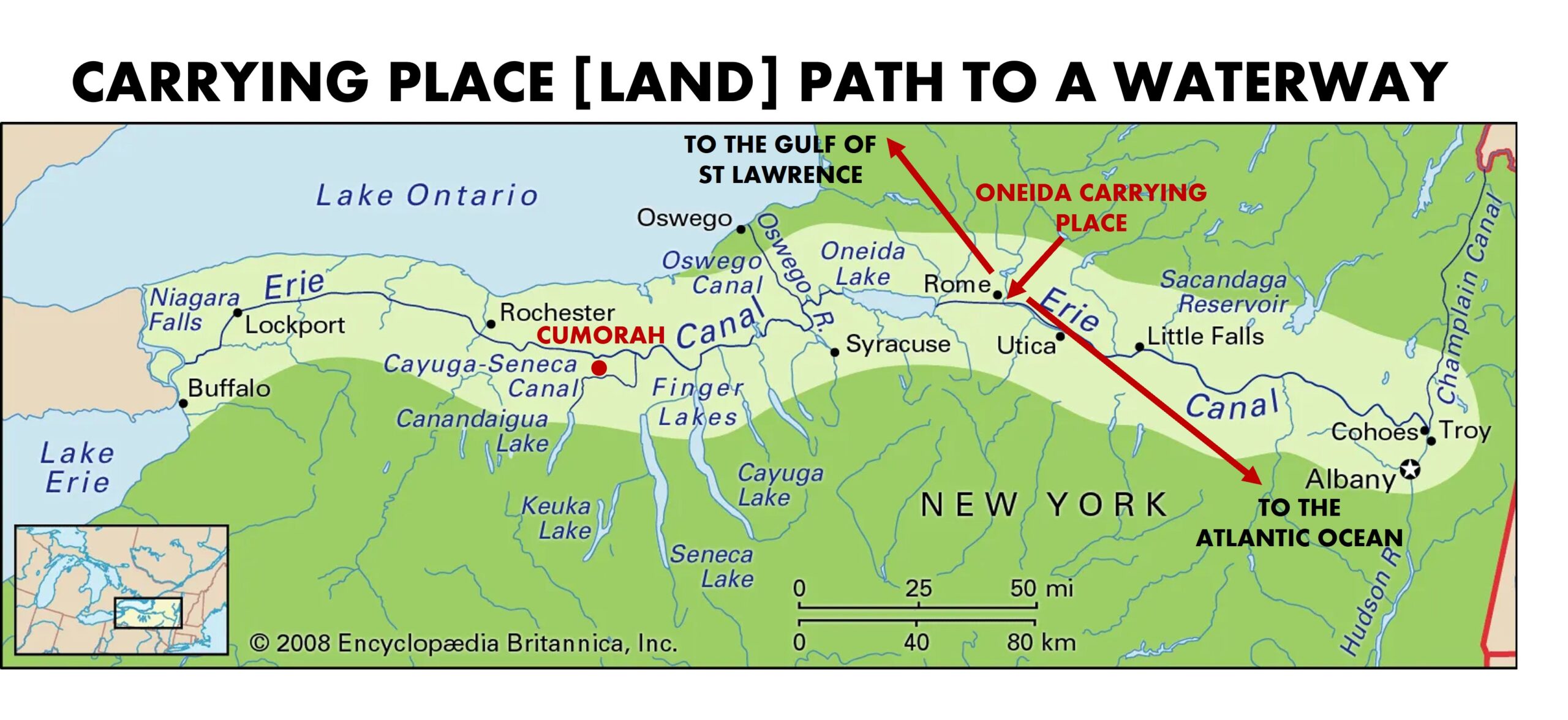
Carrying Place of the Haudenosaunee or Iroquois
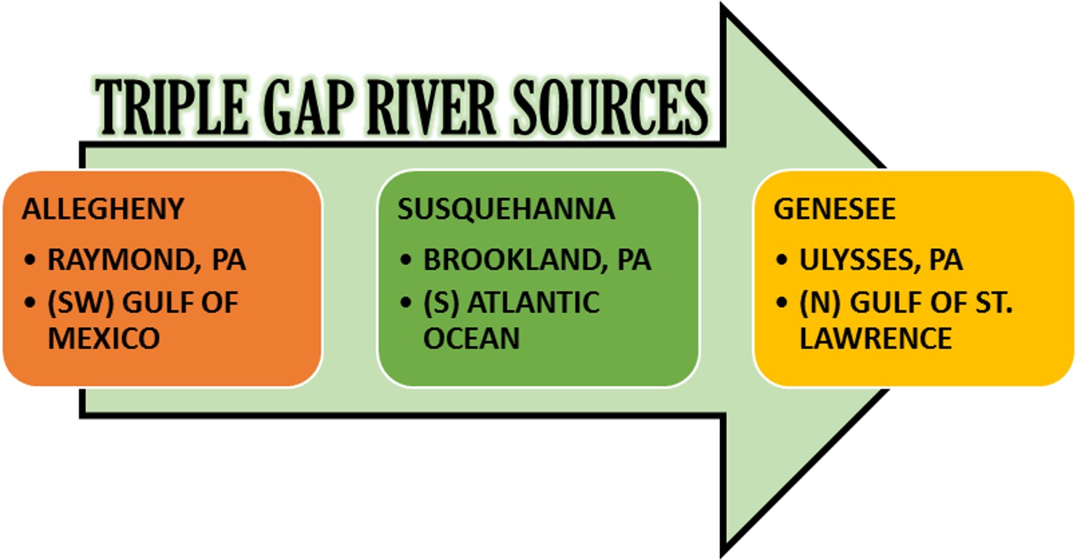
A Carrying Place is an ancient native land pass between the heads of two or more rivers, usually divided by a continental divide or other geological feature. It is a critical strategic area during war and peace to carry and transport goods. It is also a way to get from one large sea to another one. For example at the Oneida Carrying Place at Rome, NY the Natives could navigate after crossing the carrying place towards the St Lawrence Seaway or to the Atlantic Ocean.The Carrying Place near 3 cities of Brookland PA, Ulysses, PA and Raymond, PA is called a “Triple Gap.” (See picture below Sometimes the Triple divide is said to be located in Gold, PA). This is where the head of three rivers can take you to far away destinations by sea. At the Triple gap is the intersection of the St Lawrence Continental Divide and the Eastern Continental Divide, (purple dotted line on map above) a very rare place on earth. At this critical point of the two divides, the Genesee river flows north to Lake Ontario and on to the Gulf of St Lawrence. The Susquehanna River flows from the triple gap to the Atlantic Ocean, and the Allegheny River flows from the triple gap all the way to the gulf of Mexico, with no impediment. (Allegheny River to the Ohio river, to the Mississippi River, to the![]() Gulf). This Triple Gap and the Oneida Carrying Place were significant portals to travel the Land of Promise. (The Oneida Carrying Place crossing by land, would allow travel to the Gulf of St Lawrence all the way to the Atlantic Ocean by continuous river travel). I believe the rivers are the highways of the Iroquois, the Mississippian’s, the Hopewell and of course the Nephites and Jaredites.
Gulf). This Triple Gap and the Oneida Carrying Place were significant portals to travel the Land of Promise. (The Oneida Carrying Place crossing by land, would allow travel to the Gulf of St Lawrence all the way to the Atlantic Ocean by continuous river travel). I believe the rivers are the highways of the Iroquois, the Mississippian’s, the Hopewell and of course the Nephites and Jaredites.
The Oneida Indian Nation, together with officials from Oneida County and the City of Rome, recently unveiled a new bronze sculpture and public artwork that commemorates the historic Oneida Carrying Place, a vital mode of transportation, trade and commerce before and during the Revolutionary War. 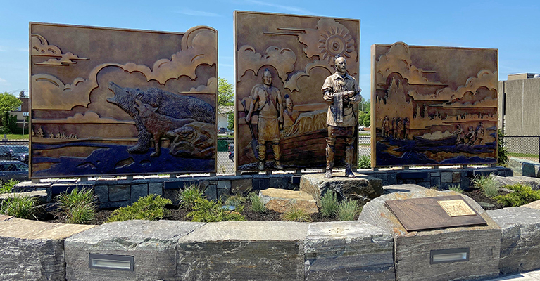
The Oneida Carrying Place played an integral role in the success of the Americans in the Revolutionary War. While it was used by the Haudenosaunee well before European settlers arrived, the path became a critical strategic area during the American Revolution when the Oneidas helped the American colonists defend nearby Fort Stanwix from a British siege. The attempted siege failed and the Americans, with their Oneida allies, helped change the momentum of the war.
Ancient Site In New York That Still Baffles Archaeologists To This Day
“There’s a small, crescent-shaped lake in central New York in the Finger Lakes Region called Lamoka Lake. It’s located between Seneca and Keuka Lake actually, but it’s not big enough to qualify as one of the Finger Lakes itself. It’s next to the small town of Tyrone – a town with a population of around 1,600 people – and the lake itself covers just 1.2 square miles.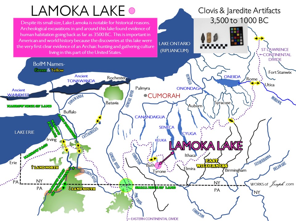
However, despite its small size, this lake is notable for historical reasons. Archeological excavations in and around this lake found evidence of human habitation going back as far as 3500 BC. This is important in American and world history because the discoveries at this lake were the very first clear evidence of an Archaic hunting and gathering culture living in this part of the United States.
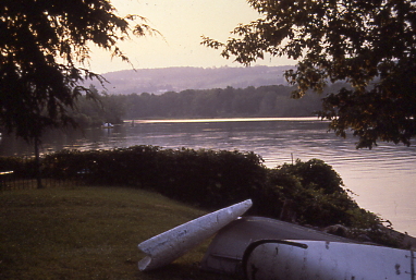


If you’re interested in the ancient history of New York, Lamoka Lake is as old as human history gets in the Empire State. Although there’s no historic site to actually visit here, just knowing that you are in the same place that history happened is a really special feeling. You can learn a bit more about the lives and culture of the Lamoka people on the Fort Stanwix National Monument website.
If you’re interested in learning more about the people of the Archaic period and their structures, check out this post about Poverty Point in Louisiana: Spend The Day Exploring These Ancient Earth Mounds In Louisiana
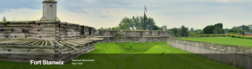
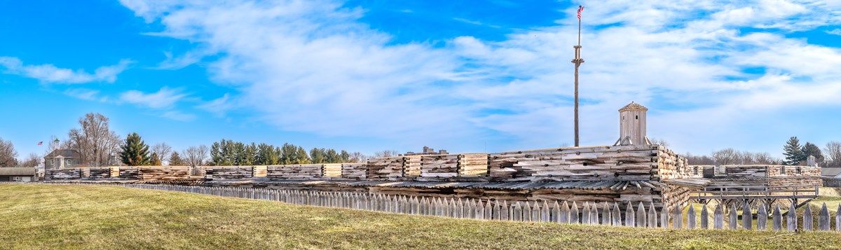
Six Miles Shared by Many Nations
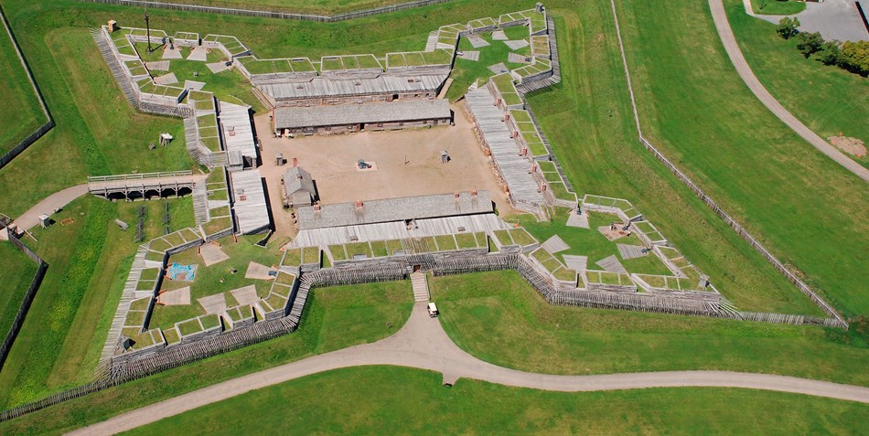
For centuries, the Oneida Carrying Place, a six mile portage connecting the Mohawk River and Wood Creek, served as a vital link for those traveling by water from the ocean to the Great Lakes. When Europeans arrived, nations fought for control of the carry, the homelands of the Six Nations Confederacy, and the rich resources of North America. In this struggle, Fort Stanwix would play a vital role. https://www.nps.gov/fost/index.htm
The history of Fort Stanwix is often thought to have begun in the 18th century. In reality, the area has been a special place to many different people over thousands of years. Like many other places around the world, Fort Stanwix has a long, rich period of history with no written record. Artifacts are often the only surviving evidence for these extensive, mysterious lengths of time. Discovered by archeologists after 4,500 years beneath the ground, this projectile point provides but one piece of the puzzle in learning about the many people who predated Europeans at the Oneida Carry.
More on the Oneida Carrying Place
One panel represents the Clans of the Oneida People – Turtle, Wolf and Bear. Another depicts Oneida men physically carrying a boat to shore. The Oneida Carrying Place served as a land bridge between the Mohawk River to the east, and Wood Creek to the west.
The center panel includes depictions of Oneida warriors and of an Oneida leader. The Oneida leader standing in front of the panel, on the stone, is holding a two-row wampum. This belt symbolizes the agreement and conditions under which the Haudenosaunee welcomed the newcomers to this land.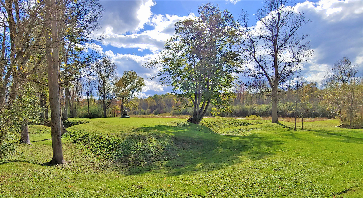
The language on the plaque at the monument reads as follows:
“The Oneida Carrying Place, known to the Oneida people as Deyowainsta (De-o-wain’-sta) or “one picks the boat up,” connected the navigable waters of the Mohawk and Hudson Rivers with Wood Creek, and hence to Lake Oneida, the Great Lakes, and the Ohio and Mississippi Rivers. This short overland portage opened up trade from the Atlantic Coast all the way to the Rocky Mountains in the west, Canada to the north, and the Gulf Coast to the south.
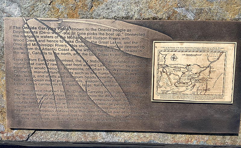
Long before Europeans arrived, the Six Nations had established trade routes that carried raw copper from around Lake Superior, pipestone from what would become Minnesota, obsidian from Wyoming and Colorado, manufactured goods such as fine hunting bows from the Ohio Valley, and shells and wampum beads from the East Coast. Later, European metal pots, utensils, weapons, and furs were added to the cargo carried on the trader’s large, flat-bottomed boats.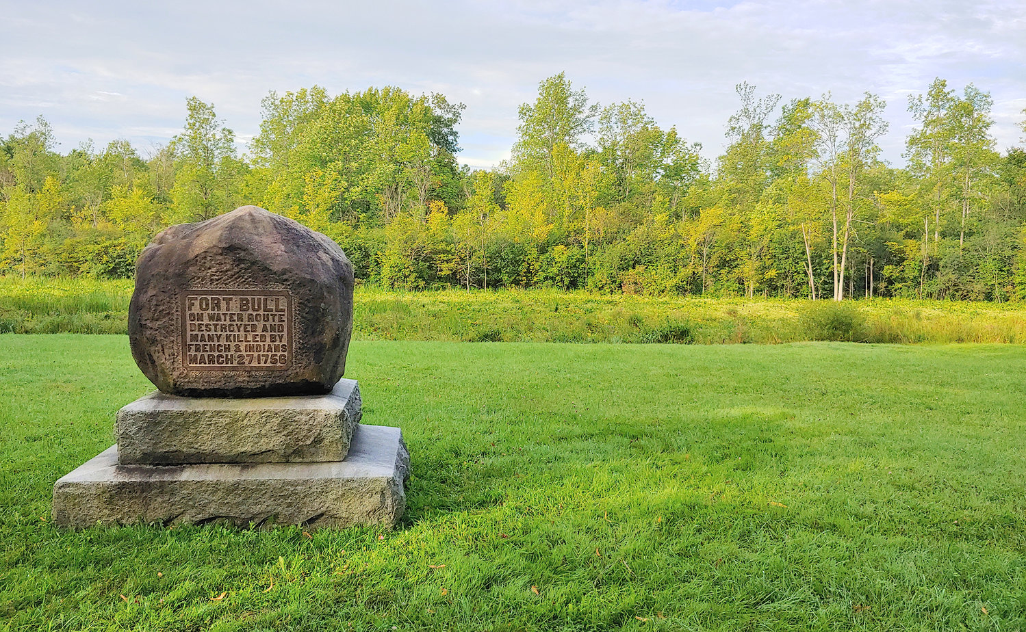
The commerce enabled by the Oneida Carrying Place also encouraged the free exchange of ideas and culture from the Atlantic Coast deep into the interior of the continent, a line of communication that established valuable ties with other Native American people and strengthened the Iroquois Confederacy. So strong were the bonds between the Iroquois nations that Benjamin Franklin and others among the new Americans were inspired by the confederacy when planning for their own union of united, yet free and independent states.”
The new bronze sculpture is located at 301 W. Dominick Street in the City of Rome, on a section of the Oneida Carrying Place which leads to Fort Stanwix. This location is to honor the Oneida people for their sacrifices that helped define the history of the United States.https://www.oneidaindiannation.com/oneida-carrying-place-sculpture-dedication-may-25-2021/