
Understanding Apologetics
![]() Apologetics cannot prove that the Church is true, but it can show you answers that may help you in knowing the Church is true, especially through personal revelation. Our Heartland group owned by Rod Meldrum, called Foundation for Indigineous Research and Mormonism,(FIRM), along with FAIR, Book of Mormon Central, The Interpreter, More Good Foundation etc., are similar organizations made up of great spiritual people who love the Lord and the Book of Mormon. All claim to have answers to many challenging or even difficult gospel questions that may encourage or assist people to better understand the truthfulness of The Church of Jesus Christ of Latter-day Saints. No Apologetic organization speaks in behalf of, or for the Church, however. Doctrine in the Church only comes from the Prophet and Apostles who all organizations support.
Apologetics cannot prove that the Church is true, but it can show you answers that may help you in knowing the Church is true, especially through personal revelation. Our Heartland group owned by Rod Meldrum, called Foundation for Indigineous Research and Mormonism,(FIRM), along with FAIR, Book of Mormon Central, The Interpreter, More Good Foundation etc., are similar organizations made up of great spiritual people who love the Lord and the Book of Mormon. All claim to have answers to many challenging or even difficult gospel questions that may encourage or assist people to better understand the truthfulness of The Church of Jesus Christ of Latter-day Saints. No Apologetic organization speaks in behalf of, or for the Church, however. Doctrine in the Church only comes from the Prophet and Apostles who all organizations support.
The purpose of LDS Apologetics is to provide solid or well-reasoned information that makes sense in answering supposed church related difficult questions, so that a conclusive decision of the truth of the Gospel and Church can be determined by study and prayer through the Spirit. The Tag line for the FIRM Foundation has always been, “Faithfully Exploring Relevant LDS Topics of Our Time.” I emphasize Exploring as we continue to look and learn, so to speak, these additional supports of our faith will continually be found.
Personal Revelation

As our dear Prophet said, “Does God really want to speak to you? Yes! “As well might man stretch forth his puny arm to stop the Missouri river in its decreed course … as to hinder the Almighty from pouring down knowledge from heaven upon the heads of the Latter-day Saints.
You don’t have to wonder about what is true. You do not have to wonder whom you can safely trust. Through personal revelation, you can receive your own witness that the Book of Mormon is the word of God, that Joseph Smith is a prophet, and that this is the Lord’s Church. Regardless of what others may say or do, no one can ever take away a witness borne to your heart and mind about what is true.
I urge you to stretch beyond your current spiritual ability to receive personal revelation, for the Lord has promised that “if thou shalt [seek], thou shalt receive revelation upon revelation, knowledge upon knowledge, that thou mayest know the mysteries and peaceable things—that which bringeth joy, that which bringeth life eternal.” Revelation for the Church, Revelation for Our Lives by President Russell M. Nelson
“No one can ever take away a witness borne to your heart and mind about what is true.”
At our Expo, see the Unveiling of Michael Bedard’s newest painting… “Hope of the World II “85 Chiefs A Remnant of The House of Israel” It has been a 7-year project and he is ready to share his art with the world.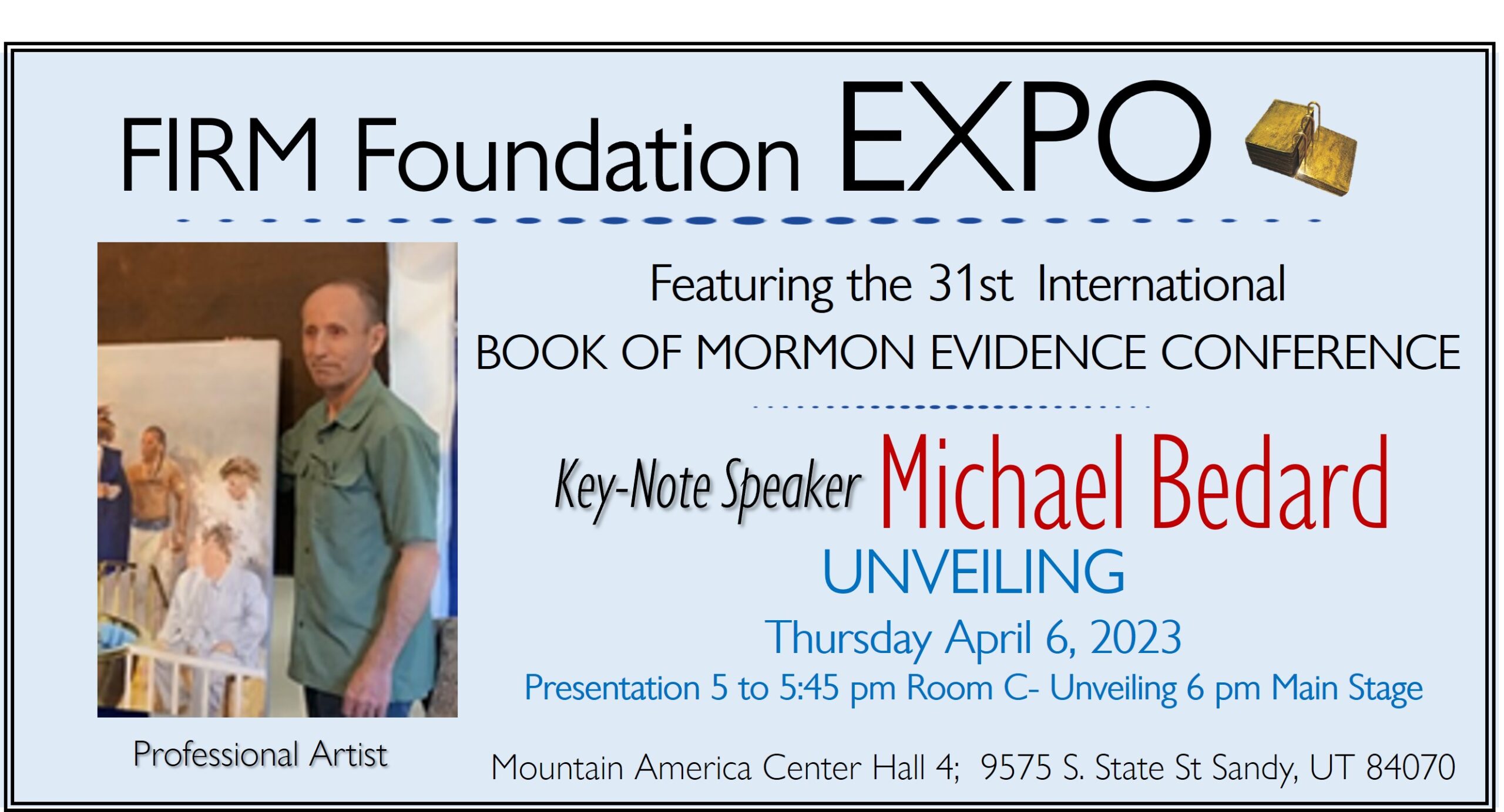
What has Happened to Faith in the Church?
It is sad to me as I see many in other Apologetics, who lack a lot of faith. For example if an archaeologist can’t find physical proof, they act like it can’t be true and they most times won’t allow the spirit to speak to them, always depending on the physical fact before they will believe. At FIRM we absolutely know by the Sprit that the Book of Mormon is true, and when we find something simple or small that makes sense, it becomes easier for us to know this additional validation of truth is most likely. We don’t out of hand dismiss an archaeological find because we can’t prove it, but we allow the spirit to work in us, which add to the our discovery of truth.
John Sorensen of the Mesoamerican Theory, “Mormon’s Codex”

“There remain Latter-day Saints who insist that the final destruction of the Nephites took place in New York, but any such idea is manifestly absurd. Hundreds of thousands of Nephites traipsing across the Mississippi Valley to New York, pursued (why?) by hundreds of thousands of Lamanites, is a scenario worthy only of a witless sci-fi movie, not of history.” John L. Sorenson, Mormon’s Codex (Deseret Book, 2013), p. 688.ANSWER: From Joseph Fielding Smith in 1954 “Doctrines of Salvation”

“LOCALE OF CUMORAH, RAMAH, AND RIPLIANCUM. This [Central American] theory of necessity, in order to be consistent, must place the waters of Ripliancum and the Hill Cumorah some place within the restricted territory of Central America, notwithstanding the teachings of the Church to the contrary for upwards of 100 years. Because of this theory some members of the Church have become confused and greatly disturbed in their faith in the Book of Mormon. It is for this reason that evidence is here presented to show that it is not only possible that these places could be located as the Church has held during the past century, but that in very deed such is the case.
Joseph Fielding Smith in “Doctrines of Salvation” Compiled by Bruce R. McConkie – Volume 3 Chapter12 “WHERE IS THE HILL CUMORAH?” (c) 1954-56 Bookcraft
Whom do you Believe?
PREFACE to Doctrines of Salvation by Bruce R McConkie:
“Joseph Fielding Smith is the leading gospel scholar and the greatest doctrinal teacher of this generation. Few men in this dispensation have approached him in gospel knowledge or surpassed him in spiritual insight, His is the faith and the knowledge of his father, President Joseph F. Smith, and his grandfather, the Patriarch Hyrum Smith. It was inevitable, therefore, that his sermons and writings should form the basis of a substantial contribution to the literature of the Church. This first-of-three volumes should find ready acceptance among gospel students everywhere. Source of the material is the published sermons and articles of President Smith as found in the various periodicals of the Church; also, the thousands upon thousands of personal letters he has written to give answers to questions raised by searchers who could not find the desired information in any published work, It follows that a host of answers will be found herein to gospel questions frequently asked, but seldom answered with the authoritative finality of the oracles of God. When President Smith speaks, it is not as the scribes. The student will do well to read the scriptural references listed in the footnotes, and to approach his study in a spirit of faith and prayerful search for ultimate truth. To many I express deep appreciation for help and encouragement: Chiefly, to President Joseph Fielding Smith, himself, for his scriptural insight, his plain teachings, and his power of expression; to Elder Oscar W. McConkie, my father, for much counsel and for many helpful suggestions; to Elder Milton R, Hunter of the First Council of the Seventy, for like assistance; to Joseph Fielding Smith, Jr., for setting the type and making many valued suggestions; to Velma Harvey and Shirley Stone Storrs, for typing the mountain of manuscripts from which the gems here published were selected; and to Harold Lundstrom, for a painstaking and careful reading of the proof.”
— Bruce R, McConkie Salt Lake City, Utah November 10, 1954.
Read or watch a video at the end of this blog, about LDS Archaeologist Thomas Ferguson, who lost his faith in the Book of Mormon.
One Cumorah- Marion G. Romney

“I will give you a lesson today that the Lord has taken great pains to bring to us… In the western part of the state of New York near Palmyra is a prominent hill known as the “hill Cumorah” (Mormon. 6:6). [There] perished at the foot of Cumorah the remnant of the once mighty Jaredite nation, of whom the Lord had said, ‘There shall be none greater… upon all the face of the earth’ (Ether 1:43, p. 461). “As I contemplated this tragic scene from the crest of Cumorah and viewed the beautiful land of the Restoration as it appears today, I cried in my soul, how could it have happened?… This second civilization to which I refer, the Nephites, flourished in America between 600 B.C. and A.D. 400. Their civilization came to an end for the same reason, at the same place, and in the same manner as did the Jaredites…I bear you my personal witness that I know that the things I have presented to you today are true—both those pertaining to past events and those pertaining to events yet to come.” (President Marion G. Romney of the First Presidency 145th Semiannual Conference, Saturday Morning Session, October 4, 1975; emphasis added.)

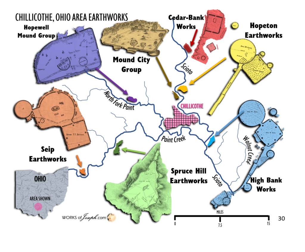
1,000,000 North American Mounds
“The most common question that is asked about mounds is, “How many exist?” In the 1800’s the Smithsonian sponsored many expeditions to identify mound sites across America. A map (shown below) was produced by Cyrus Thomas in 1894 in a Bureau of Ethnology book. They found approximately 100,000 mound sites, many with complexes containing 2 to 100 mounds. The figure of 100,000 mounds once existing— based on Cyrus Thomas map revealing 100,000 sites—is often cited by others, but that estimate is far, far too low. After visiting several thousand mounds and reviewing the literature, I am fairly certain that over 1,000,000 mounds once existed and that perhaps 100,000 still exist. Oddly, some new mound sites are discovered each year by archaeological surveys in remote areas. But in truth, a large majority of America’s mounds have been completely destroyed by farming, construction, looting, and deliberate total excavations” – Gregory L. Little, Ed.D., The Illustrated Encyclopedia of Native American Mounds & Earthworks, Eagle Wing Books, Inc., Memphis, TN [2009].
Scholars Mistaken in their Conception’s
In 1909, B. H. Roberts wrote: Let me here say a word in relation to new discoveries in our knowledge of the Book of Mormon, and for matter of that in relation to all subjects connected with the work of the Lord in the earth. We need not follow our researches in any spirit of fear and trembling. We desire only to ascertain the truth; nothing but the truth will endure; and the ascertainment of the truth and the proclamation of the truth in any given case, or upon any subject, will do no harm to the work of the Lord which is itself truth. Nor need we be surprised if now and then we find our predecessors, many of whom bear honored names and deserve our respect and gratitude for what they achieved in making clear the truth, as they conceived it to be–we need not be surprised if we sometimes find them mistaken in their conceptions and deductions; just as the generation who succeed us in unfolding in a larger way some of the yet unlearned truths of the Gospel, will find that we have had some misconceptions and made some wrong deductions in our day and time. . . . All which is submitted, especially to the membership of the Church, that they may be prepared to find and receive new truths both in the Book of Mormon itself and about it. (B. H. Roberts, New Witnesses for God, Vol. II. (3 Volumes), Deseret News: Salt Lake City, 1909, pp. 503-504)
God has Willed it!
“Have you ever tried to associate the outpouring of knowledge, the great discoveries and inventions during the past 136 years, with the restoration of the gospel? Do you not think there is some connection? It is not because we are more intelligent than our fathers that we have received this knowledge, but because God has willed it so in our generation! Yet men take the honor unto themselves and fail to recognize the hand of the Almighty in these things. America was discovered because the Lord willed it. The gospel was restored in America, rather than in some other land, because the Lord willed it. This is the land “shadowing with wings” spoken of by Isaiah that today is sending ambassadors by the sea to a nation scattered and peeled, which at one time was terrible in the beginning. (Isa. 18:1-2.) Now that nation is being gathered, and once again they shall be in favor with the Lord.” The Signs of the Lord’s Coming Joseph F. Smith J UNE 1966 The Improvement Era
“How long can rolling waters remain impure? What power shall stay the heavens? As well might man stretch forth his puny arm to stop the Missouri river in its decreed course, or to turn it up stream, as to hinder the Almighty from pouring down knowledge from heaven upon the heads of the Latter-day Saints.” D&C 121:33
Ancient Earthworks are Buildings

Dr. Roger Kennedy, the former director of the Smithsonian’s American History Museum, addressed a misperception about earth mounds, noting that earth mounds are actually buildings. Build and building are also very old words, often used in this text [his book] as they were when the English language was being invented, to denote earthen structures. About 1150, when the word build was first employed in English, it referred to the construction of an earthen grave. Three hundred and fifty years later, an early use of the term to build up was the description of the process by which King Priam of Troy constructed a “big town of bare earth.” So when we refer to the earthworks of the Ohio and Mississippi Valleys as buildings no one should be surprised.” Jonathan Neville Mounds and Mormons
Nephite Defensive Structures and Strategies
“In Alma 49, the Lamanites approach the land of Ammonihah. Mormon describes some of the defensive structures and strategies that Captain Moroni employed. Some of these were built to protect cities; others were strategic defensive positions manned by the army to protect the borders. There were also “small forts, or places of resort” (Alma 48:8). Here are verses from Alma 49.

Alma 49
2. “And behold, the city had been rebuilt, and Moroni had stationed an army by the borders of the city, and they had cast up dirt round about to shield them from the arrows and the stones of the Lamanites; for behold, they fought with stones and with arrows.
4. But behold, how great was their disappointment; for behold, the Nephites had dug up a ridge of earth round about them, which was so high that the Lamanites could not cast their stones and their arrows at them that they might take effect, neither could they come upon them save it was by their place of entrance.
18 Now behold, the Lamanites could not get into their forts of security by any other way save by the entrance, because of the highness of the bank which had been thrown up, and the depth of the ditch which had been dug round about, save it were by the entrance.” (Alma 49:2, 4, 18)
Moroni’s America
A site in southwest Ohio, near Hamilton,[i] fits this description. (Figure 53) Squier and Davis describe the location as being the summit of a hill about 250 feet high. “It is surrounded at all points, except a narrow space at the north, by deep ravines, presenting steep and almost in accessible declivities. The descent towards the north is gradual; and from that direction, the hill is easy of access.”[ii] The interior of the fortification rises in elevation so that from the top, occupants can overlook the entire adjacent countryside.
This fortified hill is not unique in this area. Squier and Davis explain:
In the vicinity of this work, are a number of others occupying the valley; no less than six of large size occur within a distance of six miles down the river. The character of this structure is too obvious to admit of doubt. The position which it occupies is naturally strong, and no mean degree of skill is employed in its artificial defences. Every avenue is strongly guarded. The principle approach, the only point easy of access, or capable of successful assault, is rendered doubly secure. A mound, used perhaps as an alarm post, is placed at about one-fourth of the distance down the ascent; a crescent wall crosses the isthmus, leaving but narrow passages between its ends and the steeps on either hand. Next comes the principal wall of the enclosure. In event of an attack, even though both these defences were carried, there still remains a series of walls so complicated as inevitably to distract and bewilder the assailants, thus giving a marked advantage to the defenders.[iii]
[i] The site can be seen on google maps here: http://bit.ly/Moroni143.
[ii] Squier and Davis, Ancient Monuments of the Mississippi Valley, p. 17.
[iii] Ibid, pp. 17-18.
Moroni’s America Page 174-5
Fortified Hill, Butler County, Ohio
“THIS fine work is situated in Butler county, Ohio, on the west side of the Great Miami river, three miles below the town of Hamilton. The plan is from a survey by JAMES MCBRIDE, Esq., and the description is made up from his notes. The hill, the summit of which it occupies, is about a half mile distant from the present bed of the river, and is not far from two hundred and fifty feet high, being considerably more elevated than any other in the vicinity. It is surrounded at all points, except a narrow space at the north, by deep ravines, presenting steep and almost inaccessible declivities. The descent towards the north is gradual; and from that direction, the hill is easy of access. It is covered with a primitive forest of oak, hickory, and locust, of the same character with the surrounding forests.” PLATE VI Ephraim George Squire

Notice how the “place of entrance” is set up to force intruders through a maze of well-defended positions. This is the type of “place of resort” where civilians could be protected with a minimal force, while the army could watch over the surrounding area.

The steep banks at the southern part of the fortification contain similar mazes.

There is not enough information in the text to identify this as a particular Nephite location, but it illustrates a manner of building defenses that the text describes. This site was surveyed in 1836, well after the Book of Mormon was published.
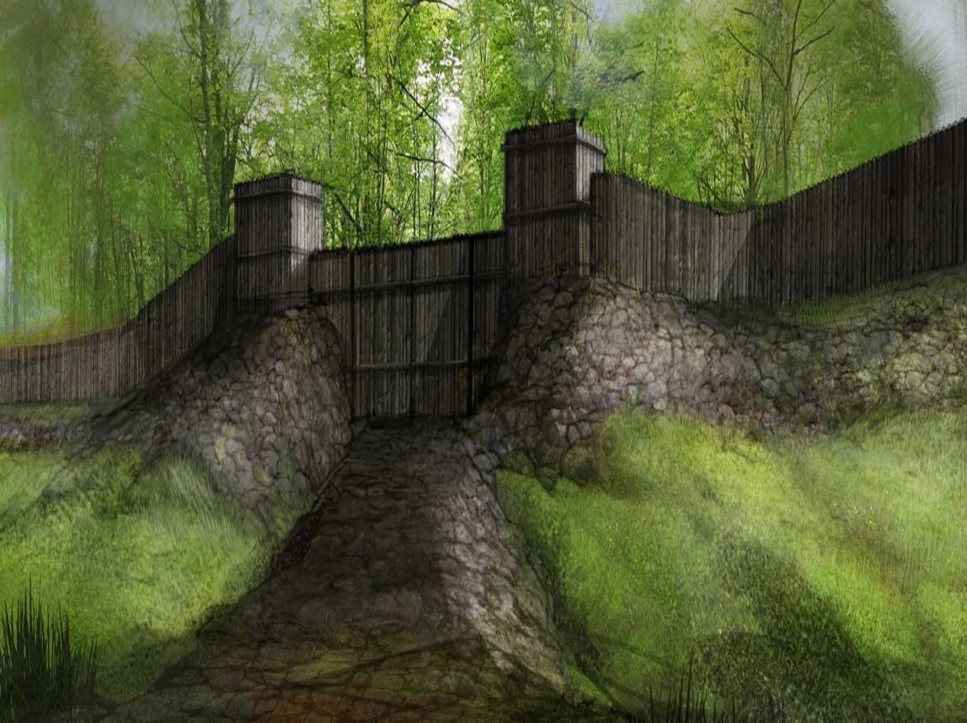
In Alma 50, Moroni continued preparations for war, causing his armies “that they should commence in digging up heaps of earth round about all the cities” (Alma 50:1). They built “works of timbers” on top of the ridges of earth, with a frame of pickets and towers. With fortifications in place, Moroni took the offensive. Perhaps he saw this as a partial fulfillment of the title of liberty; i.e., he sought to liberate all the remnant of the seed of Joseph.” Moroni’s America Page 177-8

Alma CHAPTER 50- Moroni fortifies the lands of the Nephites—
About 72–67 B.C.
1 And now it came to pass that Moroni did not stop making preparations for war, or to defend his people against the Lamanites; for he caused that his armies should commence in the commencement of the twentieth year of the reign of the judges, that they should commence in digging up heaps of earth round about all the cities, throughout all the land which was possessed by the Nephites.

Painted using the description from Alma 50 Verse 1-5
2 And upon the top of these ridges of earth he caused that there should be timbers, yea, works of timbers built up to the height of a man, round about the cities.
3 And he caused that upon those works of timbers there should be a frame of pickets built upon the timbers round about; and they were strong and high.
4 And he caused towers to be erected that overlooked those works of pickets, and he caused places of security to be built upon those towers, that the stones and the arrows of the Lamanites could not hurt them.
5 And they were prepared that they could cast stones from the top thereof, according to their pleasure and their strength, and slay him who should attempt to approach near the walls of the city.
6 Thus Moroni did prepare strongholds against the coming of their enemies, round about every city in all the land.
7 And it came to pass that Moroni caused that his armies should go forth into the east wilderness; yea, and they went forth and drove all the Lamanites who were in the east wilderness into their own lands, which were south of the land of Zarahemla.
8 And the land of Nephi did run in a straight course from the east sea to the west.
9 And it came to pass that when Moroni had driven all the Lamanites out of the east wilderness, which was north of the lands of their own possessions, he caused that the inhabitants who were in the land of Zarahemla and in the land round about should go forth into the east wilderness, even to the borders by the seashore, and possess the land.
10 And he also placed armies on the south, in the borders of their possessions, and caused them to erect fortifications that they might secure their armies and their people from the hands of their enemies.
11 And thus he cut off all the strongholds of the Lamanites in the east wilderness, yea, and also on the west, fortifying the line between the Nephites and the Lamanites, between the land of Zarahemla and the land of Nephi, from the west sea, running by the head of the river Sidon—the Nephites possessing all the land northward, yea, even all the land which was northward of the land Bountiful, according to their pleasure.

12 Thus Moroni, with his armies, which did increase daily because of the assurance of protection which his works did bring forth unto them, did seek to cut off the strength and the power of the Lamanites from off the lands of their possessions, that they should have no power upon the lands of their possession.
13 And it came to pass that the Nephites began the foundation of a city, and they called the name of the city Moroni; and it was by the east sea; and it was on the south by the line of the possessions of the Lamanites.
14 And they also began a foundation for a city between the city of Moroni and the city of Aaron, joining the borders of Aaron and Moroni; and they called the name of the city, or the land, Nephihah.
15 And they also began in that same year to build many cities on the north, one in a particular manner which they called Lehi, which was in the north by the borders of the seashore.
16 And thus ended the twentieth year.
Alma 53:4 And he caused that they should build a breastwork of timbers upon the inner bank of the ditch; and they cast up dirt out of the ditch against the breastwork of timbers; and thus they did cause the Lamanites to labor until they had encircled the city of Bountiful round about with a strong wall of timbers and earth, to an exceeding height.
ROMANS OF THE NEW WORLD
“As early as 1620 the tribe called Andastes dwelt in the valley of the Susquehanna… They are spoken of by different writers under various names, the most frequent of which are Susquehannocks, Minquas, and Conastogas. It was this fierce and warlike people who probably constructed the mounds and fortifications, the crumbling ruins of which were distinctly visible a hundred years ago. They were the builders, probably, of the earthworks which once existed on the bluff near the mouth of Wolf Run, which were visited and described by Conrad Weiser in his first journey up the West Branch in 1737.
AMERICAN INDIAN FORTIFICATIONS
“He informs us that the fortification was on a height and was surrounded by a deep ditch. The earth was thrown up in the shape of a wall, about nine or ten feet high and as many broad… Its ruins showed it to have been curved at the extremities so as to extend to the edge of the cliff, which was very steep and probably twenty feet high. At the base now flows a stream known as Wolf Run….There was a ditch on the east side from which the earth was taken to form the embankment. It is believed this work was surrounded by palisades, and that it possessed gates made of timber. When Conrad Weiser saw it in 1737 it was so old that the timber had succumbed to the ravages of time… The builders of this fortification probably constructed the mound which the whites found on an open plain not far from the north bank of the river… It was symmetrical in form, and on account of its antiquity was regarded as a prominent landmark… The mound was visited in 1839 by O. S. Fowler, the phrenologist, who was in search of crania. He was accompanied by several other gentlemen, of Muncy… Many bones and fragments were found after digging, but only one nearly perfect skull was secured… the mound was undoubtedly a place of burial, and on account of the great number of implements of war, and trinkets, found in its soil, a large number of bodied had been deposited there… Notwithstanding the aborigines of this valley, like all others of their class, were called savages, they were withal a noble race when in their primitive condition, and by some writers they have been styled the Romans of the New World.” History of Lycoming County, PA edited by John F. Meginness; ©1892

Ohio’s Hebrew Earthworks

Also know as the “East Fork Works” or “Gridiron,” these ancient massive earth work walls, described by some as a fortification, depict Hebrew symbols. There were over 200,000 ancient cities and burial mounds (See Video) left by these pre Columbian cultures. Thomas Jefferson was fascinated by the ancient earthworks of North America and made a special study of them. George Washington explored the lands of the “Mound Builders” and Benjamin Franklin and Noah Webster puzzled over their strange mysteries. Now only a fraction remain. A great number of these structures were intentionally destroyed, some by farmers and others by our government. Ohio’s Hebrew Earthworks destruction came by the hands of our own government.
NY County Fortifications near Hill Cumorah
General occupation. Ontario county and the region about it was one of the most important regions occupied by the Seneca Indians during the middle colonial period, as is attested by the several villages and the many evidences of occupation. A review of the sites in this county shows that there were places occupied in precolonial times by the Senecas, the best known site of this earlier period being that on the Reed farm in the town of Richmond, and on the outlet of Hemlock lake. So important a portion of the Seneca county or Sonontouan was this territory that the various French invaders who sent their troops against the Iroquois directed much of their energy to the destruction of the Seneca villages and farm lands in Ontario county… A later record by Father Jocques Fremin in 1668 names four villages within the jurisdiction of St Michels mission. The three villages which he named out of the four are Gandachiragon, Gandougarae, Gandagora. The second named was composed of refugees and captives from three extinguished nations, the Neuters, Hurons and the Onondaga’s.
In 1669 Brehant de Galinee, one of the companions of Count LaSalle, described one of the principal villages of the Senecas as being on the brow of a hill and in a clearing about 2 leagues in circumference. This town he said was composed of a ” lot of cabins surrounded with palisades of poles, 12 or 13 feet high,, fastened together at the top and planted in the ground, with great piles of wood the height of a man behind these palisades, the cabins being not otherwise flanked, merely a simple inclosure, perfectly square.” Sonontouan, in his description, was “composed of four villages, two of which contained 150 cabins each and the other two about 30 cabins. New York State Museum JOHN M. CIARKE, Director E ARCHEOLOGICAL HISTORY OF NEW YORK BY ARTHUR C. PARKER, ARCHEOLOGIST

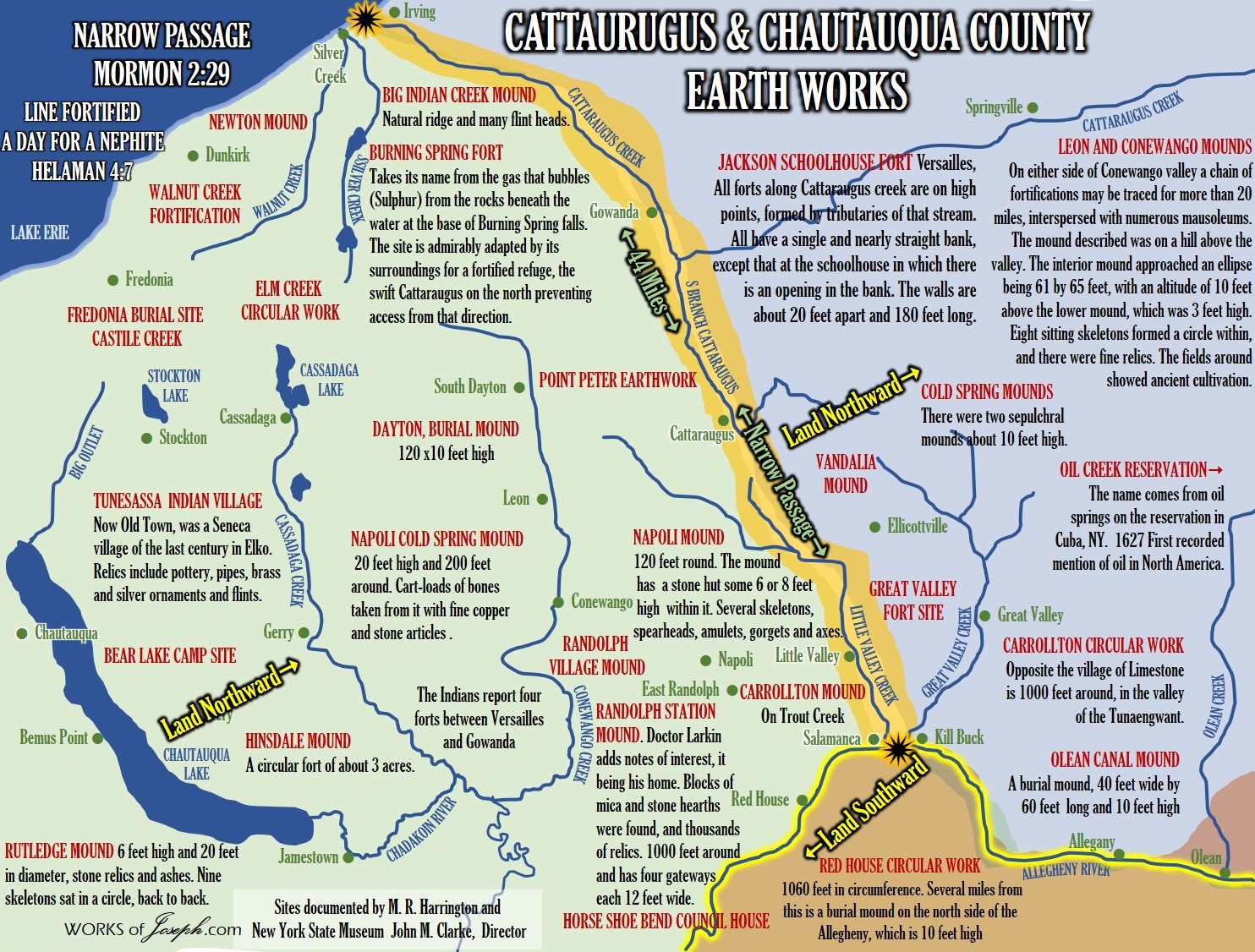
Narrow Passage
Irving NY (Land North) to Salamanca, NY (Land South)
ON THE SOUTH SIDE OF LAKE ERIE, THERE IS A SERIES OF OLD FORTIFICATIONS, RUNNING FROM THE CATTARAUGUS CREEK TO THE PENNSYLVANIA LINE, A DISTANCE OF FIFTY MILES; some are two, three, and four miles apart, and some within half a mile. Some contain five acres… Still further south, there is said to be another chain of forts running parallel with the former, and about the same distance from them as those are from the lake… Whether the nations, which possessed our western country before the Iroquois, had erected those fortifications to protect them against their invaders, or whether they were made by anterior inhabitants, are mysteries which cannot be penetrated by human sagacity; nor can I pretend to decide whether the Eries or their predecessors raised the works of defense in their territory; but I am persuaded that enough has been said to demonstrate the existence of a vast population, settled in towns, defended by forts, cultivating agriculture, and more advanced in civilization than the nations which have inhabited the same countries since the European discovery.” Clinton, De Witt. A Memoir On The Antiquities Of The Western Parts Of The State Of New-York

is the “Day and a Half for a Nephite.”
HARNESSED ELEPHANT ON COPPER PLATE
“In the year 1859, while exploring some tumuli in the vicinity of the Red House valley, we found numerous singular and interesting relics, among which were spear heads, six inches in length, with double barbs composed of masses of native copper; also several blocks of mica, which were in about the same condition as when chiseled from the granite of the Allegany Mountains. It was near this valley where was found one of the most interesting relics ever discovered among the works of the ancient inhabitants. It was a flat piece of native copper, six inches in length by four in width, artistically wrought, with the form of an elephant represented in harness engraved upon it, and a sort of breast collar, with tugs on either side, which extended past the hips.” Historical Gazetteer and Biographical Memorial of Cattaraugus County, N.Y. edited by William Adams
“THE PRINCIPAL ARCHEOLOGICAL CENTERS IN CATTARAUGUS COUNTY
1. The regions about the mouth of Cattaraugus creek and along its bank as far south as Gowanda;
2. In the valley of the Conewango, in the vicinity of Conewango village and within the township of Conewango ranging northward into Leon along a large tributary on the Conewango creek;
3. The township of Randolph;
4. The valley of the Allegheny from Limestone on the east to Onoville on the west. The Allegheny valley contains numerous remains of all the various occupations mentioned.
5. The Allegheny valley from Vandalia running through O’lean to Carroll on the east;
6. Other minor localities are the valley of Cold Spring creek, running northward into the town of Napoli, the valley of Big Indian creek in the town of Perrysburg, and the hilly region in the town of Persia just west of the branch of the town of Cattaraugus.

OUTPOSTS FOUND AT ALL EASILY ACCESSIBLE PARTS OF THE BANKS.
They were probably intended as vantage places from which the enemy could be fought and driven down the slope. That these walls and trenches are artificial is shown by the fact that potsherds, fire-broken stones, chipped flint and stone implements were found below the modern bottoms of the trenches. The earth of which the walls are composed prove to have been thrown up by man because of the disturbance of the regular strata of the soil. The fort is separated from the point of which it is a part by a wall 205 feet in length that curves irregularly from bank to bank… The base of the wall is 14 feet in thickness while the depth from the crest of the wall to the outer edge of the excavation is 16 feet. The average height of the wall from the bottom of the trench is 5 feet. A depression in the top of the wall at this point seems to indicate an ancient gateway. The site is of early Iroquoian occupation and metallic implements or evidences of European contact were discovered.

NEARLY EVERY STREAM that is bordered by fertile lands, were once occupied by the mound builders. Vestiges of ancient works are numerous, such as military fortifications, sepulchral mounds, flint arrowheads, mica and copper relics.
IN CATTARAUGUS COUNTY, the Iroquois exterminated the Erie about 1654 The Seneca, had villages and defensive works after that. It would appear that the earliest occupants to leave definite traces of village life were branches of the Algonkian family.
JACKSON SCHOOLHOUSE FORT Versailles, NY. All forts along Cattaraugus creek are on high points, formed by tributaries of that stream. All have a single and nearly straight bank, except that at the schoolhouse in which there is an opening in the bank. The walls are about 20 feet apart and 180 feet long.” Archeological Investigation conducted by Schoolcraft, Cheney, Adams, Larkin and Macauley, The principal scientific investigations conducted by M. R. Harrington and New York State Museum John M. Clarke, director Archeological History of New York and by Arthur C. Parker, Archeologist, 1922
Cattaraugus & Chautauqua County Earth Works
Gallery of Maps Purchase over 200 Maps here


Question asked at the beginning of the blog and answered again here!
What has Happened to Faith in the Church?
Answer: From Thomas Ferguson
Thomas Stuart Ferguson (May 21, 1915 – March 16, 1983) was an American lawyer, a Mormon and an amateur archaeologist who dedicated his life to finding archeological evidence of the Book of Mormon in Mesoamerica. He was instrumental in the foundation of the New World Archaeological Foundation. He initially believed that the history of Mesoamerican cultures provided support to the historicity of the Book of Mormon, but towards the end of his life came to the conclusion that the Book of Mormon was not a historical book…
Ferguson began to work on the idea that the Book of Mormon could be examined for evidence. The dominant theory within The Church of Jesus Christ of Latter-day Saints (LDS Church) at the time was that the Book of Mormon took place over the entire Western Hemisphere. Ferguson became convinced that the geography was limited to Central America…
In April 1953 Ferguson met with the First Presidency and other leaders of the LDS Church to ask for $15,000 for the current year and $120,000 for the next for years funding NWAF. Church president David O. McKay replied, “Brother Ferguson, you are a hard man to stop.” A week later the LDS Church agreed to donate $15,000 on the condition that no publicity be attached to the donation in any way or any time. Ferguson spent the remainder of the year in Tabasco and Chiapas, believing it to be the location of a Book of Mormon city Zarahemla. In August 1953 Ferguson asked for additional funding from the LDS Church but only received $1,000; he effectively shut down NWAF in 1954.
In January 1955 Ferguson wrote to the First Presidency asking again for funding, “To confirm Book of Mormon history through archaeological discoveries is to confirm revelation to the modern world. … I know, and I know it without doubt and without wavering, that we are standing at the doorway of a great Book of Mormon era.” This time, the LDS Church donated $200,000 to fund NWAF for four seasons…
When asked in 1976 if he still had faith, he responded, “I think the LDS Church is better than any other brand of organized religion and I have not lost faith in very large segment of it.”
Later in 1976, fifteen years removed from any archaeological involvement with the NWAF, referring to his own paper, Ferguson wrote a letter in which he stated:
“The real implication of the paper is that you can’t set the Book-of-Mormon geography down anywhere—because it is fictional and will never meet the requirements of the dirt-archeology. I should say—what is in the ground will never conform to what is in the book.”
In 1983, a couple months before his death, Ferguson went with Howard W. Hunter on his final trip to Mexico for NWAF. He died unexpectedly from a heart attack while playing tennis at the age of 67.
Ferguson had purportedly been working on a book length manuscript that would “expose Joseph Smith as a fraud”; however, this final manuscript has never surfaced.

Watch the video above or Read Article Here titled How a Mormon lawyer transformed archaeology in Mexico—and ended up losing his faith