The Rejection of the Two Cumorah Mesoamerica Geography Theory for The Book of Mormon by Stephen Reed
“The so-called Two Cumorah Mesoamerica Geography Theory for The Book of Mormon was created by a member of The Reorganized Church of Jesus Christ of Latter-day Saints (The RLDS Church).
His name is Louis E. Hills or L.E. Hills. He was a member of the First Quorum of The Seventy of that Church. He introduced this theory in 1917, during World War I. In 1918, one year later, the Spanish Flu Pandemic was in full force.

Source: https://en.wikipedia.org/wiki/Spanish_flu

Source: http://www.latterdaytruth.org/pdf/101221.pdf
Here are some screenshots of entries in The Saints’ Herald starting in the year 1917.
The Church of Jesus Christ of Latter-day Saints announced on March 17, 2020 the digitization project of Community of Christ historical records:
https://history.churchofjesuschrist.org/blog/new-digital-records-available-community-of-christ-digitization-project?lang=eng
You can view The Saints Herald, here:
https://catalog.churchofjesuschrist.org/record/1effb3dd-9c95-4ef1-be8f-770c848e38c2/0?view=brow
1917
This entry notes L.E. Hills offered his copyrighted maps to The RLDS Church, during a Priesthood Meeting on Thursday April 12, 1917 at 10:45 a.m.
1917 online calendar:
https://www.timeanddate.com/calendar/?year=1917&country=1 It was referred to a committee to report a year hence.


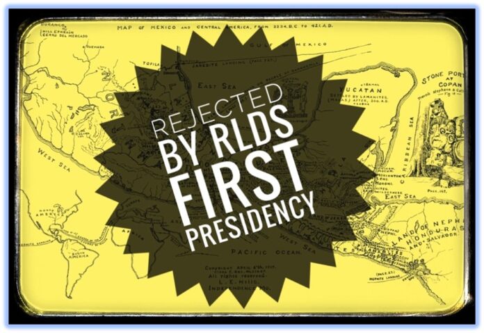
This is that 1917 zinc etching. Hills dated it April 6, 1917 in honor of the events of that day in April 1830. Source: link to the source for this map, page 2
From the: “Review of Glen Scott’s Map – Jul/Aug 2008” At this link
On May 2, despite his map not being accepted but still under review, L.E. Hills gave lectures about his map at the “Religio Society,” a type of Seminary and Institute organization. The Herald states that his ideas were a viewpoint “not altogether generally taken by The Saints.”
Notice the mention of World War I and contributions to the war effort.

In the years 1918 and 1919, The Saints’ Herald appears to not have mentioned L.E. Hills. During these two years, L. E. Hills published two books. They can be found on line at HathiTrust in digital format:
1918
Book by L.E. Hills at HahtiTrust.org:
1918 A SHORT WORK ON THE POPOL VUH AND THE TRADITIONAL HISTORY OF THE ANCIENT AMERICANS BY IXT-LIL-XOCHITL
https://babel.hathitrust.org/cgi/pt?id=njp.32101078161690&view=1up&seq=5&skin=2021
1919
Book by L.E. Hills at HahtiTrust.org:
1919 HISTORICAL DATA FROM Ancient Records and Ruins OF Mexico AND Central America
https://babel.hathitrust.org/cgi/pt?id=loc.ark:/13960/t39z9z24w&view=2up&seq=4&skin=mobile
His second 1919 map is on Pages 34-35:

Link to the source for this map, pages 34-35 with a foldout view
In 1921, L.E. Hills continued lecturing on his views, during visits to RLDS Branches in Iowa.
1921


On August 23, 1921, Daniel MacGregor of the Second Quorum of The Seventy (RLDS Church) praised L.E. Hills’ new map. He mentions securing the “ATLAS” of L.E. Hills, indicating that Hills used other maps to come up with his own map and theory for The Book of Mormon. This use of a Rand McNally Atlas and maps, can be verified with other Community of Christ documents.


Source: http://www.latterdaytruth.org/pdf/101221.pdf
This next entry on October 11, 1921 is a report by a Branch President in Moorehead, Iowa, mentioning both L.E. Hills and Daniel MacGregor.

Then on December 13, 1921, The Saint’s Herald published a November 15, 1921 Notice by The First Presidency of The Reorganized Church of Jesus Christ of Latter-day Saints, rejecting the work by Elder L.E. Hills.
It’s obvious that members of The RLDS Church were confused as to why L.E. Hills was promoting his map and ideas that The Book of Mormon and the Hill Cumorah were restricted to the geographical area of Central America.
Members sent in “numerous reports and inquiries” to the office of The First Presidency touching on the recent activities of a member of their First Quorum of Seventy.

It’s apparent that L.E. Hills was using his Church position and the resources of his Church to promote his ideas. He wrote his two books to try to convince his fellow members.
There is more to this history, from1923 – 1925. Despite this 1921 Notice, L.E. Hills continued to promote his maps and ideas. But to keep this from being too lengthy, I’ll mention that history another time.
As you can see, the leadership of The Reorganized Church of Jesus Christ of Latter-day Saints rejected M2C or the so-called Two Cumorah Mesoamerica Geography Theory for The Book of Mormon in 1921.
You may not care, but The President of The RLDS Church in 1921, was a grandson of The Prophet Joseph Smith, President Frederick M. Smith. Dr. Smith acquired a Ph.D. in Psychology. One can safely assume the Smith Family knew where Cumorah was located and it was not in Central America.
The 100th Anniversary of this rejection will occur on November 15, 2021
This theory, 100 years later, is being promoted by members of the True Church, The Church of Jesus Christ of Latter-day Saints. One wonders why?
But then you realize L.E. Hills copyrighted his maps and books in his name. He died, his books and maps remained in “public and personal libraries, used book stores”, and his copyrights have expired. His works are now in The Public Domain. Anyone can now resell them even after modifying them. Stephen Reed


