
“Nearly all those familiar with the early statements by the Prophet Joseph Smith touching on potential Book of Mormon lands know that he clearly indicated them to be in North America. This is evident in the historically verified accounts wherein he declared revelation such as in the Wentworth Letter, the American Revivalist Account, the Zelph Accounts and Joseph’s handwritten letter to Emma while on Zion’s camp. In addition, the prophet revealed a Nephite altar at Adam-ondi-Ahman, mentioned the land of Manti was near Huntsville, Missouri, and revealed that this land was “the borders of the Lamanites” (see D&C 54:8). Furthermore he received revelation from the Lord for the location of Zarahemla (see D&C 125:3) and New Jerusalem (see D&C 84:1-6) which Christ Himself declared to be on Book of Mormon lands (3 Nephi 20:22), both of which are absolutely located in North America. These accounts and their indications are not speculation based, but historically documented fact.

Mesoamerican theorists are thereby forced to claim that the Prophet Joseph Smith reneged on these early revelations after being introduced to a New York Times best-selling travel book by John Lloyd Stevens called “Incidents of Travels in Central America, Chiapas and Yucatan.” They feel that Joseph learned more about Book of Mormon geography from this travelogue than from his angelic visitations by Moroni, other ancient prophets, or his translation of the sacred text itself. We believe based on D&C 125:3 that the Prophet Joseph Smith received this revelation, that the Zarahemla of the Book of Mormon is across the river from Nauvoo, in the Montrose, Iowa area.” Rod Meldrum Firm Foundation President
Read the complete blog here titled Zarahemla in Iowa


| The above map was drawn by Robert E. Lee in 1834 when he came as a young Army officer to deal with the geology of the Keokuk Gorge that stopped riverboats on the Mississippi. Lee came with a company of soldiers. He wanted to determine if it would be possible to create a channel for riverboats to go through the Des Moines Rapids. From 1834 to 1837, Robert E. Lee and his men built an outpost known as Fort Des Moines No. 1. In 1837 the U.S. Army abandoned the outpost. From 1839 to 1846, Montrose became a landing place for many Mormons who were refugees from Missouri and immigrants from Europe. At first, the Saints lived in Lee’s abandoned barracks. The town soon became known as Montrose. Among the town’s residents were Brigham Young, Wilford Woodruff, and Erastus Snow. Indeed, Nauvoo’s streets aligned to the streets of Lee’s map for Fort Des Moines. For eight years, there were thousands of more Mormons living in Montrose than the town’s current population of 898. Montrose then as well as now had a town area of one square mile or 640 acres. In our research for the Fires of Zarahemla, we scanned the cropland of 21 acres inside the square mile of the city’s limits. Charcoal samples from the ground of this land will be the basis for determining the Carbon-14 dates of the fires. It seems strange that we have started our detailed search for the City of Zarahemla on a site that Mormons farmed many years before they went to the Salt Lake Valley. It also seems strange that when we look at old maps, we find that the Mormons in the mid-nineteenth century named the very road next to this site as “Zarahemla Road.” We will take core samples from the ground that the first generations of Mormons farmed more than 150 years ago when they associated the land with the City of Zarahemla. This result was certainly not our intention. We went to the site because it had a cornfield that is well suited for the SENSYS MX V3 scan. Nevertheless, we are grateful that we can start on a site that was part of the Saints’ early history. We take comfort in the fact that we are so close to the faith of the first believers in this Last Dispensation. 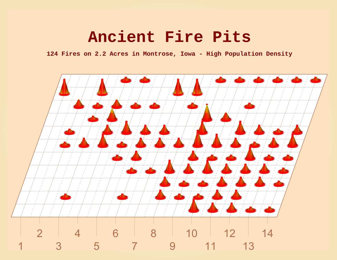 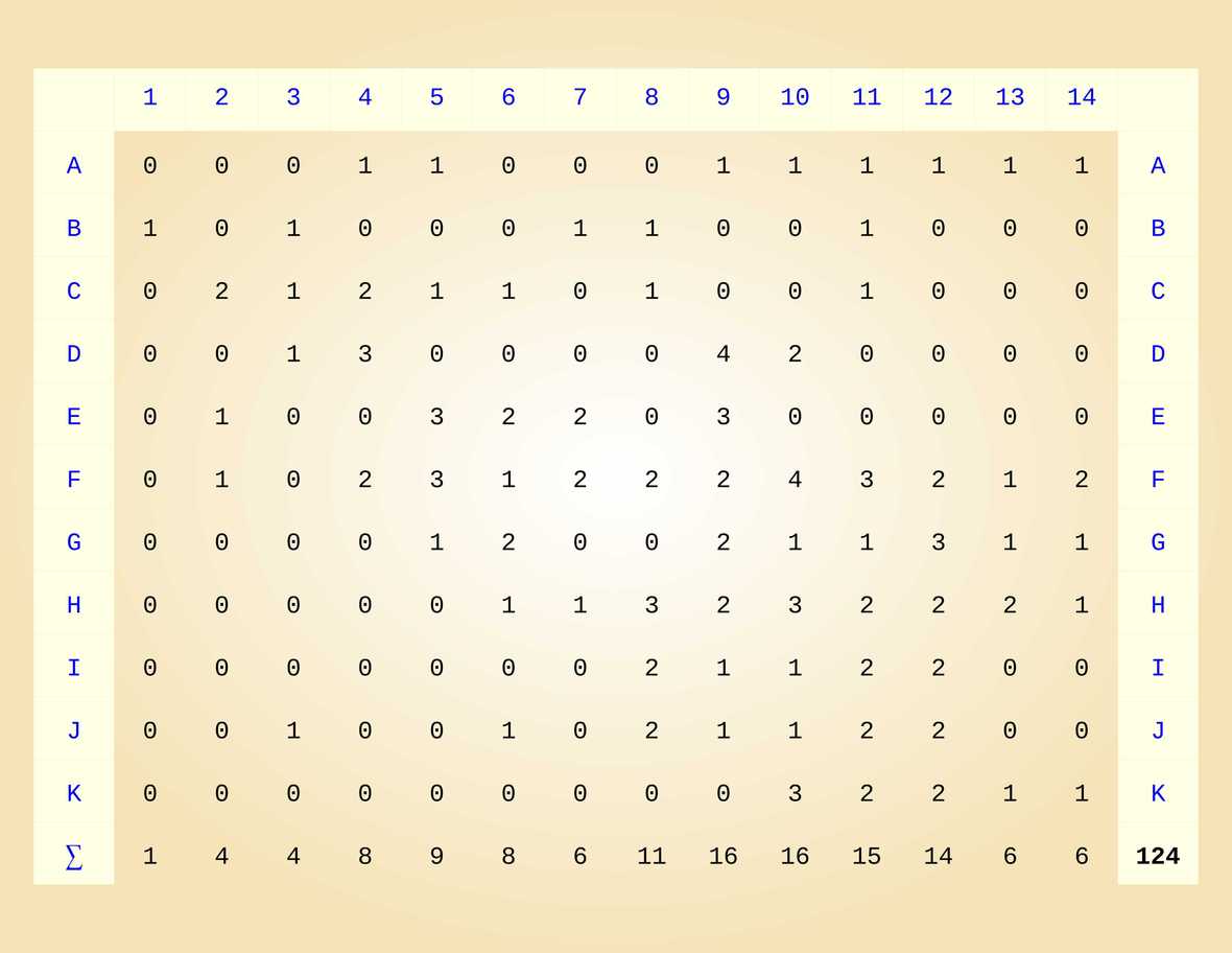 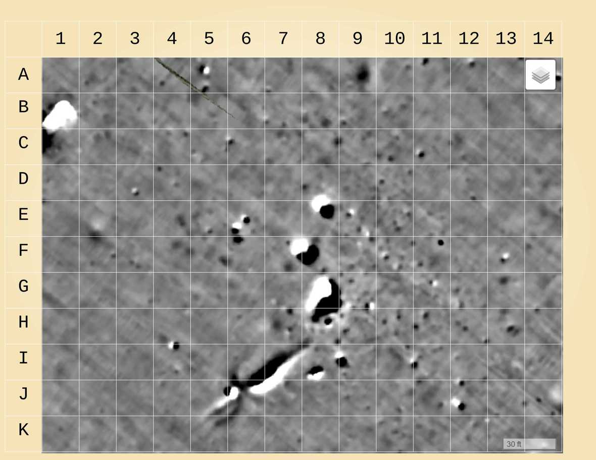 The full grid represents an area of about 2.2 acres. Preliminary calculations indicate that there are as many as 124 ancient fires in the ground of this area. Core soil samples will provide pieces of charcoal from the fire pits for which Carbon-14 dating will determine the distribution of the fire pits over a timeline before the arrival of the Europeans to Iowa. The high density of fire pits correlates with a high density of ancient populations. The assumption is that each fire pit would have represented three people and that one acre of fire pits as found on the grid would have meant a density of populations for hundreds of people per acre over many generations. This result certainly supports the idea that this scanned land was a small part of the Lost City of Zarahemla. 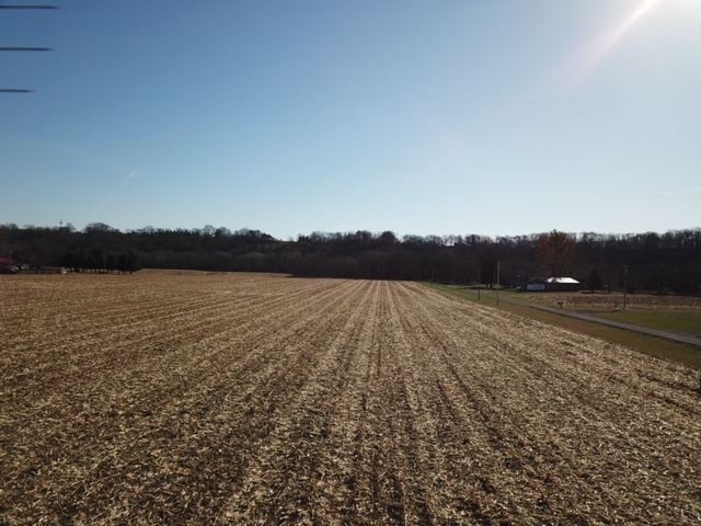 The above picture is from the surface of land that we scanned on November 18th, 2020, from a cornfield within the city limits of the City of Montrose, Iowa. This field has been under cultivation for more than 150 years. European settlers have not made any major disturbances on this land.Our magnetic scan showed fire pits and lightning strikes from ancient times. Almost 200 years of farming provided the necessary revenue to protect farmland from development. The cultivation of corn for six generations gave a protective cover for the evidence in the ground. Because of corn, we got the magnetic scans that made it possible to create digital maps that show traces of habitation for an ancient city. Donate at www.zarahemla.site 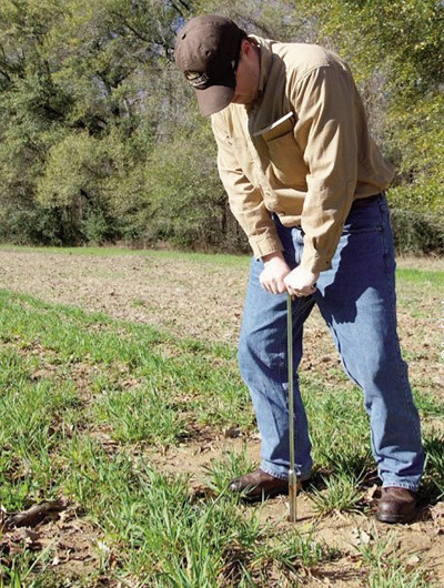 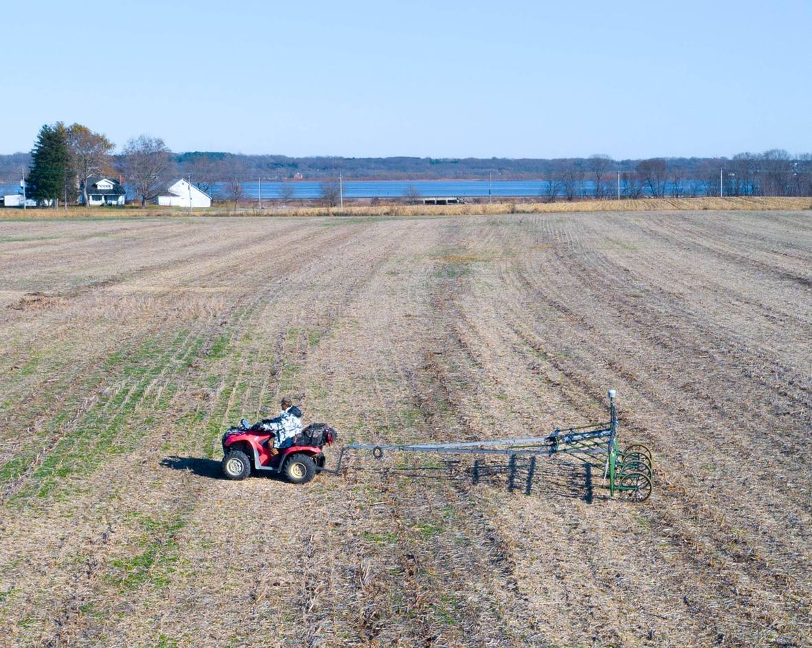 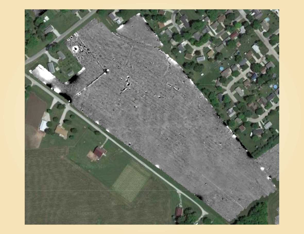 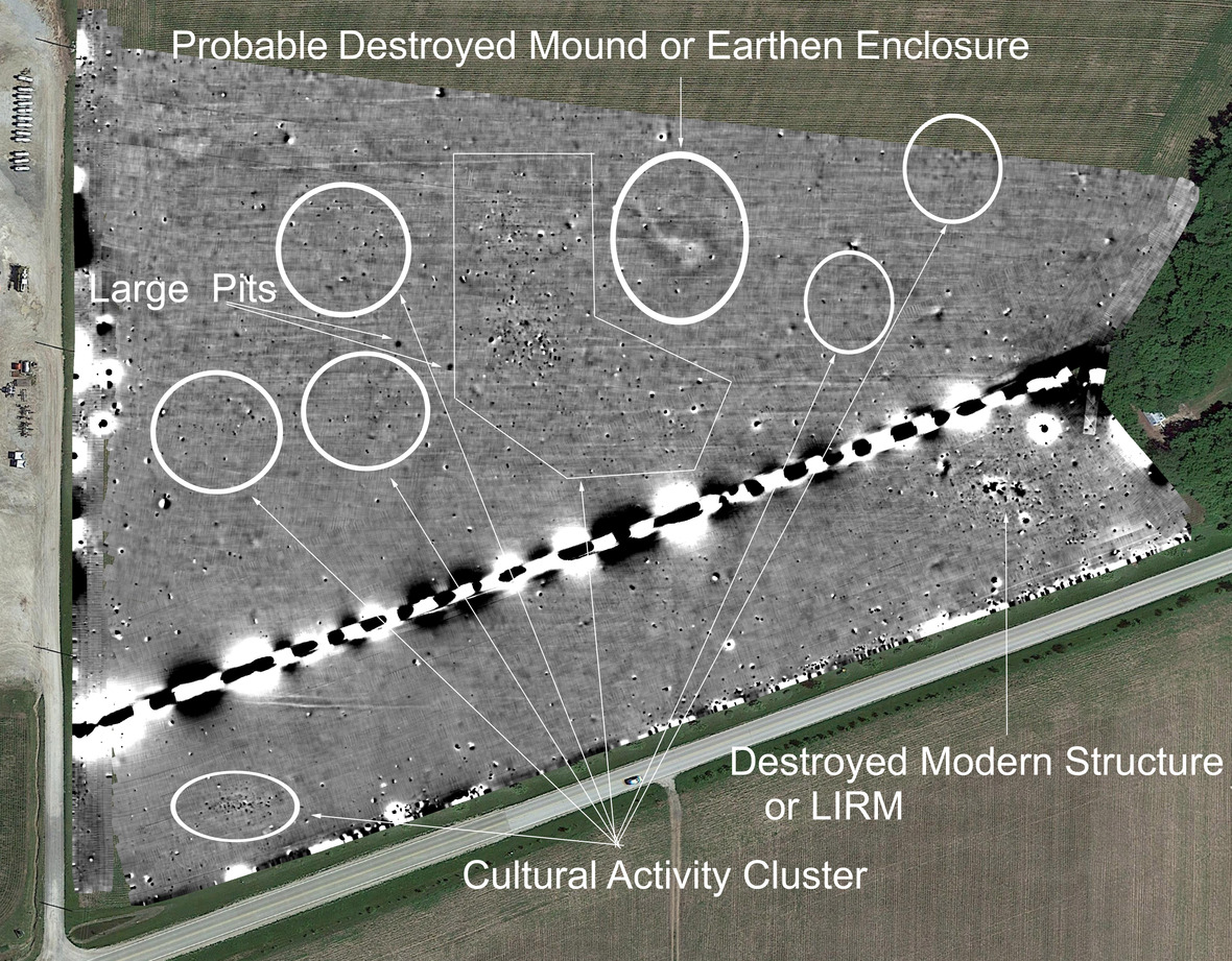 ©2020 Zarahemla | 2681 Milan Street Easton, PA 18045 US |