One of the great myths that is promoted by those who believe the Mesoamerican setting for the Book of Mormon, is that there in a lack of evidence of any large battle at Hill Cumorah. They always speak of no arrowheads being found on or around the Hill Cumorah thus this proves the final battles were on some other hill in Mexico. They choose Mexico because that is where the many monuments and pyramids were found in about 1842. Another problem with these pyramids is they are dated from 700 to 1000 AD, long after the Nephites would have lived there.
Part 1 Below is from Ted Dee Stoddard who is a huge Mesoamerican supporter. Part 2 are evidences from many Heartlanders finding all types of arrowheads on and around Hill Cumorah and the mid-west of North America.
Mesoamerican Theorists also ask, “where are all the large cities in North America?” We can show thousands of cities in Mesoamerica. In North America we can find millions of Mounds and Cultural Centers especially all over the Eastern part of North America. See maps below.
You will probably realize the Myth of “No Arrowheads” near Cumorah
is all fabricated.

Part1 Mesoamerican Theory
EVIDENCES THAT THE BOOK OF MORMON TOOK PLACE IN MESOAMERICA
Why Mesoamerica?
Criteria for Book of Mormon Lands and People
There are several theories held among Latter-day Saints for the location of Book of Mormon lands. Some place the geography of the book in upstate New York or near the Great Lakes. Others look to Peru and South America, or to the Baja Peninsula, or Texas, and some even propose the Malaysian Peninsula. BMAF supports a Mesoamerican context for the major Book of Mormon sites. Other locations may meet some of the following criteria, but only Mesoamerica meets all these elements required by the book itself. This list of criteria is not a cafeteria list. Any Book of Mormon lands proposal must be able to demonstrate all.
| A Narrow Neck of land and 4 seas (east, west, north, and south) | |
| A major river running south to north from a narrow strip of wilderness | |
| A high civilization with cities, kings, artisans, military, and priests | |
| An agricultural base large enough to support several millions of people | |
| A highly literate (written language) society with scribes as important officers | |
| Functional calendar and dating systems | |
| A merchant class using weights and measures | |
| Engineers to build houses, temples, towers, and highways using cement | |
| Highly skilled craftsmen working with precious metals and stonework | |
| A warrior society involved in large battles using trained soldiers and sophisticated fortifications | |
| Legends of a white, bearded God |
The Demise of One “Mormon Myth” about the Hill Cumorah
by Ted Dee Stoddard, Phd BMAF Board of Advisers
In recent Book of Mormon Archaeological Forum email circles, we’ve been discussing the need for conducting soil samples around the Hill Cumorah in upstate New York to verify whether hundreds of thousands of Jaredite, Nephite, and Lamanite soldiers indeed lost their lives around the hill. If they did, soil samples would confirm the presence of higher-than-normal levels of calcium and phosphate from the skeletal remains of the deceased soldiers. I personally think the Hill Cumorah soil-sample “evidence” that some Book of Mormon readers “teach” is nothing more than a “Mormon myth,” but I’m willing to bide my time until my thinking is confirmed or until I have to “eat crow” as a result of my thinking.
I’m guilty—and I admit it—of promoting several Mormon myths while I was a missionary for The Church of Jesus Christ of Latter-day Saints in the 1950s. One particular myth I “taught” dealt with warfare artifacts, especially arrowheads, which presumably had been found around the Hill Cumorah in upstate New York. During each fourth discussion, the Book of Mormon lesson, I routinely said something like the following: “Proof that tremendous ancient battles took place around the Hill Ramah/Cumorah comes from the arrowheads that have been found around the hill where the last great battles of the Jaredites and Nephites-Lamanites took place. Archaeologists and others have picked up bushel basket after bushel basket of arrowheads around the hill.”
I now know that such comments represent the epitome of what I fondly refer to as a “Mormon myth.” I didn’t teach the Cumorah arrowhead myth because I was deceitful. I firmly believed the account that had been passed on to me by other senior missionaries who helped prepare me for missionary work. In connection with the Cumorah arrowhead myth, the excerpts from the letter that follows were written by Langdon Smith, a member of the Church who, upon his retirement, did archaeological investigations around the Hill Cumorah area in upstate New York. The letter as given below is taken from the second edition of Exploring the Lands of the Book of Mormon by Joseph Lovell Allen and Blake Joseph Allen, pages 702–3. At the time he wrote the letter, Langdon had not been exposed to the thinking that the “real” hill Cumorah of the Book of Mormon was located in Mesoamerica.
To: Book of Mormon Archaeological Digest
From: Langdon Smith, New Haven, Vermont, 2001
| Working with the state archaeologists I get to see things the average person does not see. Awhile ago I saw the state site map for the state of New York. With my interest in history and pre-historic times, I looked around Palmyra. South of Syracuse on the east below this area there are several campsite areas as well as below Rochester to the west, but up around the Palmyra area it is several miles to the closest listed sites. Wherever there are early American sites, collectors will find them. Plowed fields are the best places to look and there are plowed fields in the Palmyra area. . . . On my own or as I work with professionals I find early sites. At this time I have found 298 new early American campsites. I have reported these and obtained site numbers from the state historic preservation office. . . . So I do have experience in searching out and finding sites. . . . I have read the stories written by Mr. Bean and also Mrs. Samson as they lived in the Hill Cumorah area. Stories which state how they, when plowing in the area, would pick up arrowheads by the basketful and then sell them to the tourists. . . . Having this interest in artifacts, out I drove to the Cumorah area. . . . I searched the field on the east, then went to the farm north of the Hill and asked to look through their fields. They stated that I was the first one that they knew of to go out looking for arrowheads there. . . . I did not find one single piece of evidence of any kind. There were not any arrowheads, nor were there any pieces of broken flints that would have been left over from the making [of arrowheads]. . . . Chips are always left. Why pick them up? They are waste. There are about 75–85% waste in making artifacts. Langdon Smith |
In the full text of his letter, Langdon refers to a man who lived in the Palmyra region who was a collector of artifacts. The man was not a member of the Church, but he had read the Book of Mormon. According to Smith, the elderly man, whose name is J. Golden Fisher, stated, “There just aren’t any artifacts of the kind spoken of in the [Book of Mormon] around that hill.” Langdon concludes by expressing his faith that the Church is true and that the Book of Mormon is a second witness of Christ. He then says, “But the battle, well, it must have been fought at some other hill.”
Langdon’s comments add to my chagrin for teaching the “arrowhead Mormon myth” about Cumorah while I was a missionary. Such outcomes naturally make me interested in having answers to the following questions: Are Mormon missionaries today still teaching the Cumorah arrowhead myth? Are they also teaching what will likely turn out to be a Mormon myth about purported soil samples associated with Cumorah?
More information: Stoddard, Ted Dee Topic/Type: Book of Mormon Names and Places The Great Lakes”Heartland” ModelE-mail Articles
Part 2 Heartland Model
“One of the old Indian Trails which became the route of the first road of the white man in this area, from Canandaigua Lake, two miles south of the Hill to Lake Ontario twenty-two miles north passing the “nose” of the Hill Cumorah. The finding of Indian arrow and spearheads in great quantities on the slopes of the Hill and in the fields surrounding it indicates that long after the great battle in which the Nephites were annihilated Hill Cumorah has been an important battle ground. Willard Bean’s experience coincides with Giles’ conclusion as he found many arrowheads and artifacts as he visited and worked on the Hill Cumorah in the early 1900’s.” A STUDY OF THE HILL CUMORAH: A SIGNIFICANT LATTER-DAY SAINT LANDMARK IN WESTERN NEW YORK Cameron J. Packer Religious Education Master of Arts
“We visited the Hill Cumorah and were accorded the courtesy of going thereon by the wife of Mr. George Sampson, a brother of Admiral Wm. Sampson, who before his death owned the property. When we went up there and looked around, we felt that we were standing on holy ground. The brethren located, as near as they thought was possible, the place from which the plates of the Book of Mormon were taken by the Prophet. We were delighted to be there. Looking over the surrounding country we remembered that two great races of people had wound up their existence in the vicinity, had fought their last fight, and that hundreds of thousands had been slain within sight of that hill. Evidence of the great battles that have been fought there in days gone by are manifest in the numerous spear and arrow-heads that have been found by farmers while plowing in that neighborhood. We were fortunate enough to obtain a few of the arrowheads.” (George Albert Smith, Conference Report, April 1906, Third Day—Morning Session p. 56)
In New York State Bulletin #2 it is documented that several miles south of “Mormon Hill,” as it was then called, a site was found where flint arrowheads and spear points and many unfinished weapons were found in great abundance. All of the above sources are cited in Brenton G. Yorgason, Little Known Evidences of the Book of Mormon, 1989, p. 10.
![]()
Tickets: Schedule of Speakers:
Artifacts near Montrose Iowa
Jerry Sloat/ June 28, 2000, Daily Democrat, Fort Madison, Iowa.
The wooded hills and ravines along the rivers in this area were popular Indian hunting and camping grounds for hundreds of years before the appearance of white settlers. So the archeological survey to be conducted prior to construction work in Happy Hollow this year should result in some interesting finds.
Although the climate of the Midwest is not conductive to the preservation of wood, leather or bone, an abundance of stone remnants of past Indian cultures, arrowheads, axe heads, knives, pestles, and other stone implements — were once easily found in the smaller streams and freshly plowed fields along the Mississippi, Skunk and Des Moines river valleys.
Three or four generations ago nearly every young boy owned a cigar box full of such treasures. Many were broken pieces or arrowheads, shards of pottery, spear points and effigy good luck stones. Perfect, unbroken pieces were true collectors items, and many a boy or young man who was an avid artifact hunter, and perhaps bit of a shrewd trader to boot, built impressive collections of Indian implements.
There are still many such collectors around. But with the passing years actually finding an artifact is becoming harder and harder. Many collectors now depend upon trading or buying the choice specimens needed to complete a display.
Perhaps one of the most plentiful sources of Indian artifacts in this area has been the area around Montrose. Because of its location along the rapids of the Mississippi, and the excellent fishing there, it is believed that Indian villages of one sort or another have been there for a thousand years. When the white settlers first appeared here it was the location of a Sac and Fox encampment called “Cut Nose Village.” Until they were driven out by the Sac and Fox, it was thought to be the location of an Illini Indian village. Before that it was probably once occupied by the Iowa tribe, and even earlier, by the prehistoric Woodland Indian civilizations who disappeared so mysteriously.
In the late 19th century nearly everyone in Montrose had a collection or Indian artifacts. Fred Green found a 15 pound stone axe head in such perfect condition that it is now in a British museum.
J.B. Kiel collected dozens of stone axe heads, and more than a thousand arrowheads, spear points, knives and grinding stones. He sold and gave hundreds of them to the Smithsonian Institute and the Davenport Academy of Science.
Manessa Reeves was digging a trench in front of his store at Montrose and unearthed a war axe weighing over seven pounds but it was an imperfect specimen because a sizable chunk had been broken off. Ray Rigby found a four pound stone pestle that had probably been used to grind hominy, a favorite Indian food.
Among the more unusual finds was one by Fred Barker. His was a large double-edged axe with a hole drilled through it for a handle. Most stone axes were grooved on either side so that the split end of a handle could be tied to it.
On his farm just below Montrose, Jerry Anderson collected 20 hatchets, axes and mortars as well as a large number of stone knives, spear points and arrowheads. They were found in such a small area that Anderson believed it must have been either a manufacturing location or a storage place.
The Montrose area was so rich in Indian artifacts that they can still be found in numbers there. When Paul Hellige built a new house in the Schlotter addition near Montrose a couple of dozen years ago, he found many arrowheads while digging the basement.
It is unlikely that Happy Hollow was ever as popular an Indian location as Montrose. But when the Sac and Fox Indians laid seige to the original Fort Madison during the War of 1812, they had to have a sizable camp nearby. What would have been a better location — close by, but still out of sight and sound of the fort — than Happy Hollow! By John Lefgren
Support for Arrowheads, Artifacts, and Mounds, near Zarahemla.

John Lefgren and Wayne May are ready to do some scanning in Montrose, Iowa. They will be looking for evidence of ancient people living in that area during the time of the Nephites. The Germans with their world famous SENSYS Magnetometry equipment will be flying into Iowa to do the scanning. Below is a brief description of what they will be doing from Nov 9-12, 2020.
Support for Arrowheads, Artifacts, Pottery, Head and Breastplates near Cumorah.
There is much evidence for arrowheads all over Cumorah!
bofm.blog/arrowheads-the-cave-and-actual-stone-at-cumorah/
bofm.blog/hill-cumorah-archaeological-verification/
bofm.blog/mounds-skeletons-artifacts-near-cumorah/
bofm.blog/jaredites-nephites-josephites-final-battle-at-cumorah/
bofm.blog/bones-at-cumorah/
bofm.blog/a-study-of-the-hill-cumorah-a-significant-latter-day-saint-landmark-in-western-new-york/
 Hundreds of Thousands of Arrowheads USA
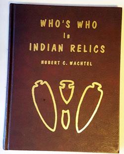
Who’s Who in Indian Relics Volumes 1-16 acres not like any other Who’s Who book. It is entirely a book of photographed artifacts, showing thousands and thousands of pictures of authentic prehistoric artifacts. There are 16 volumes and about 400 pages in each all in full color. It chronicles present day collectors and their collections. Artifact identification. Published by The Messenger Printing Co., Kirkwood., 1988


Over 1,000,000 Mounds
“The most common question that is asked about mounds is, “How many exist?” In the 1800’s the Smithsonian sponsored many expeditions to identify mound sites across America. A map (shown below) was produced by Cyrus Thomas in 1894 in a Bureau of Ethnology book. They found approximately 100,000 mound sites, many with complexes containing 2 to 100 mounds. The figure of 100,000 mounds once existing— based on Cyrus Thomas map revealing 100,000 sites—is often cited by others, but that estimate is far, far too low. After visiting several thousand mounds and reviewing the literature, I am fairly certain that over 1,000,000 mounds once existed and that perhaps 100,000 still exist. Oddly, some new mound sites are discovered each year by archaeological surveys in remote areas. But in truth, a large majority of America’s mounds have been completely destroyed by farming, construction, looting, and deliberate total excavations” – Gregory L. Little, Ed.D., The Illustrated Encyclopedia of Native American Mounds & Earthworks, Eagle Wing Books, Inc., Memphis, TN [2013].


State of Ohio over 8,500 Culture sites of 50 to 100 mounds each.
