
In my five posts here at BOFM.BLOG, I realize I have provided a lot of detailed information about this RLDS origin of the Two Cumorah Mesoamerica geography theory for The Book of Mormon.
Blog 1 July 22 THE ORIGIN OF THE TWO CUMORAH MESOAMERICA GEOGRAPHY THEORY FOR THE BOOK OF MORMON
Blog 2 Aug 11 THE REJECTION OF THE TWO CUMORAH MESOAMERICA GEOGRAPHY THEORY FOR THE BOOK OF MORMON
Blog 3 Aug 20 REJECTED TWICE BY THE RLDS FIRST PRESIDENCY
Blog 4 Aug 30 THE RLDS BOOK OF MORMON MAP DEBATE OF 1924
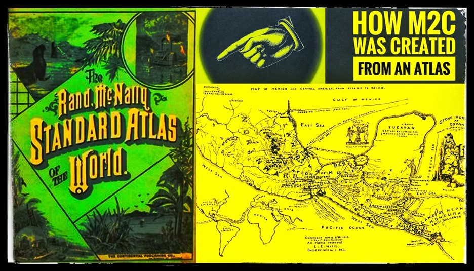
Blog 5 Sept 2 HOW M2C WAS CREATED FROM AN ATLAS
I also realize very few will take the time or have the patience to study and understand all of it.
But please understand, that The Prophet Joseph Smith had nothing to do with this silly geography theory created in 1917 now being promoted by our leading LDS scholars.
This short nine-year history from 1917 to 1925, with the death of Louis E. Hills, as clearly reported in The Saints’ Herald, explains its origin and history. Anyone who claims it’s the Truth, are actually perpetuating a lie.
Anyone who claims Joseph Smith was its author, is bearing false witness against the Prophet. Those who promote this theory, are “loving and making a lie.” (D&C 63:17; 76:103)
Dr. John L. Sorenson in his 1990 book, The Geography of Book of Mormon Events: A Source Book in .pdf format here, mentions Louis E. Hills and his works:
On page 31, Sorenson wrote of L.E. Hills and even enumerated Hills’ accomplishments:
“Hills, an RLDS student of the Book of Mormon, seems to deserve credit for many innovations:
(1) the first regionally limited model,
(2) that the lands where Book of Mormon events took place comprised exclusively Mesoamerica,
(3) that the Isthmus of Tehuantepec was the narrow neck,
(4) that the Usumacinta was the Sidon, and
(5) the first comprehensive attempt to utilize secular scholarly literature (on the native chronicles or traditions) to settle Book of Mormon questions.
The first point involves both the landing of Lehi’s party in Central America and the presence of the hill Cumorah of the final Nephite battles in Mexico; actually, then, the concept of “two Cumorahs” goes back at least 75 years.” (Published in 1990)
Sorenson here admits The Prophet Joseph Smith had nothing to do with a “two Cumorahs” concept for the geography of The Book of Mormon.
The following four-page document (bottom, below), written by Louis E. Hills, describes how he created his Two Cumorah Mesoamerica geography theory for The Book of Mormon.
This document was obtained from the Community of Christ Library and Archives. It is undated, but was written during this 1917- 1925 timeframe, as L.E. Hills had mentioned during this period in his lectures or before the Committee, about using his Atlas, as noted in The Saints’ Herald, August 23, 1921, quoting Daniel MacGregor:


These three items or “secular scholarly literature” mentioned by Dr. John L Sorenson in his “Source Book,” were used by L.E. Hills. I have provided links to them online, sans the map:
Bulletin 28, Bureau of American Ethnology pages 327-330 (Dated 1904)
https://library.si.edu/digital-library/book/bulletin281904smit
Rand McNally Map of Central America – (unavailable not knowing the year used)
Bulletin 28, Bureau of American Ethnology page 247 (Dated 1904)
https://library.si.edu/digital-library/book/bulletin281904smit
These are screen shots from his document I consider shows the lack of logic, by L.E. Hills:


This is the logic behind the so-called Two Cumorah Mesoamerica geography theory for The Book of Mormon – the use of Maps from an Atlas and reports from the Smithsonian Institution.
There is no citing the Prophet Joseph Smith, his revelations, nor the scriptures. This is simply a fantasy of the mind using private interpretations of the scriptures and the teachings of men.
This is what has afflicted and confused members of The Church of Jesus Christ of Latter-day Saints since at least 1979 when F.A.R.M.S. was created, by its owners, employees, volunteers, and donors, and its spinoffs, today called “Book of Mormon Central” and “Interpreter Foundation” and their business affiliates. They promote L.E. Hills’ geography theory.
Follows, is the four-page document written by Louis E. Hills, explaining how he came up with his now so-called Two Cumorah Mesoamerica geography theory, restricting the geography of The Book of Mormon to Central America.
Stephen Reed
Mesa, Arizona


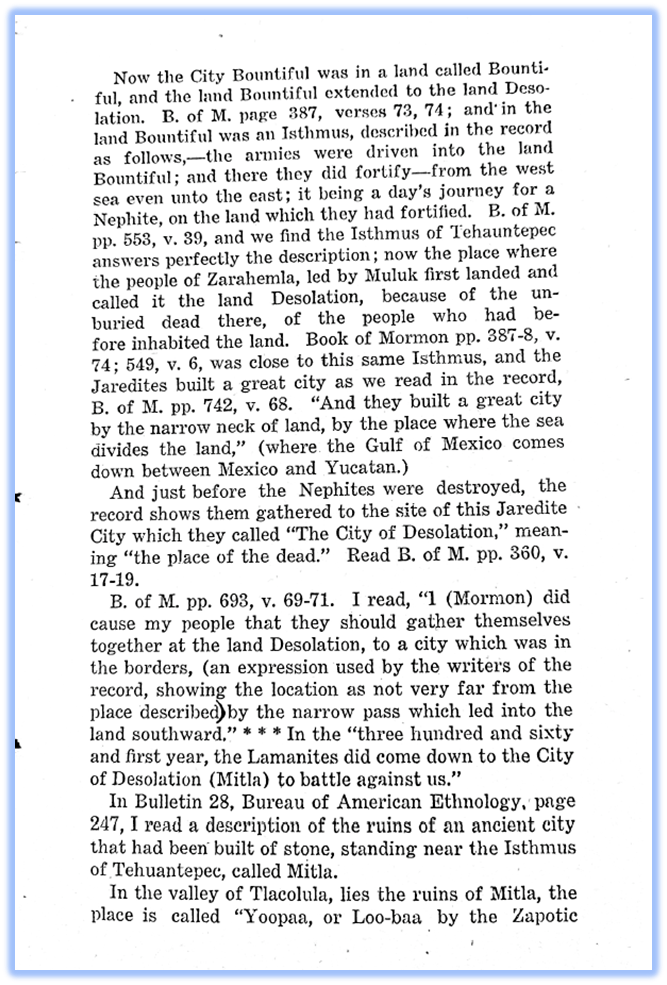

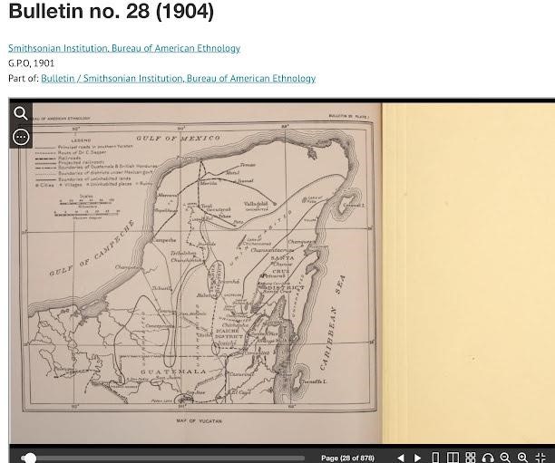
This image is from the Smithsonian report that LE Hills wrote that he used to come up with his geography theory.