
“The discovery of stone tools alongside mastodon bones in a Florida river shows that humans settled the southeastern U.S. up to 1,500 years earlier than scientists previously believed.” Analise Hollingshead, a former graduate student at Florida State University, contributed to this article.
If you would like to see other examples of Mastodon’s in Florida, another article called “Discovery Points to Earlier Arrival of First Americans” found here:
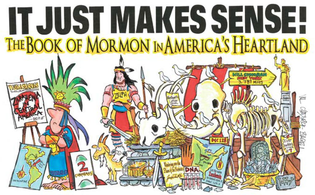
Curelom and Cumom/Mammoth and Mastodon?
Speaking of Mastodon’s, as we read in Ether 9:19, “And they also had horses, and asses, and there were elephants and cureloms and cumoms; all of which were useful unto man, and more especially the elephants and cureloms and cumoms.” These useful animals were most likely the Mammoth, and Mastodon.
In reference to anachronistic 19th century terminology like Curelom and Cumom, Jonathan Neville said, “In my view, God prepared Joseph Smith for his future role as translator and prophet. His life-threatening leg infection led Joseph to become a young religious seeker. His pursuit made him well-informed and conversant on religious topics, enabling him to become an active translator of the engravings on the plates. (continued)
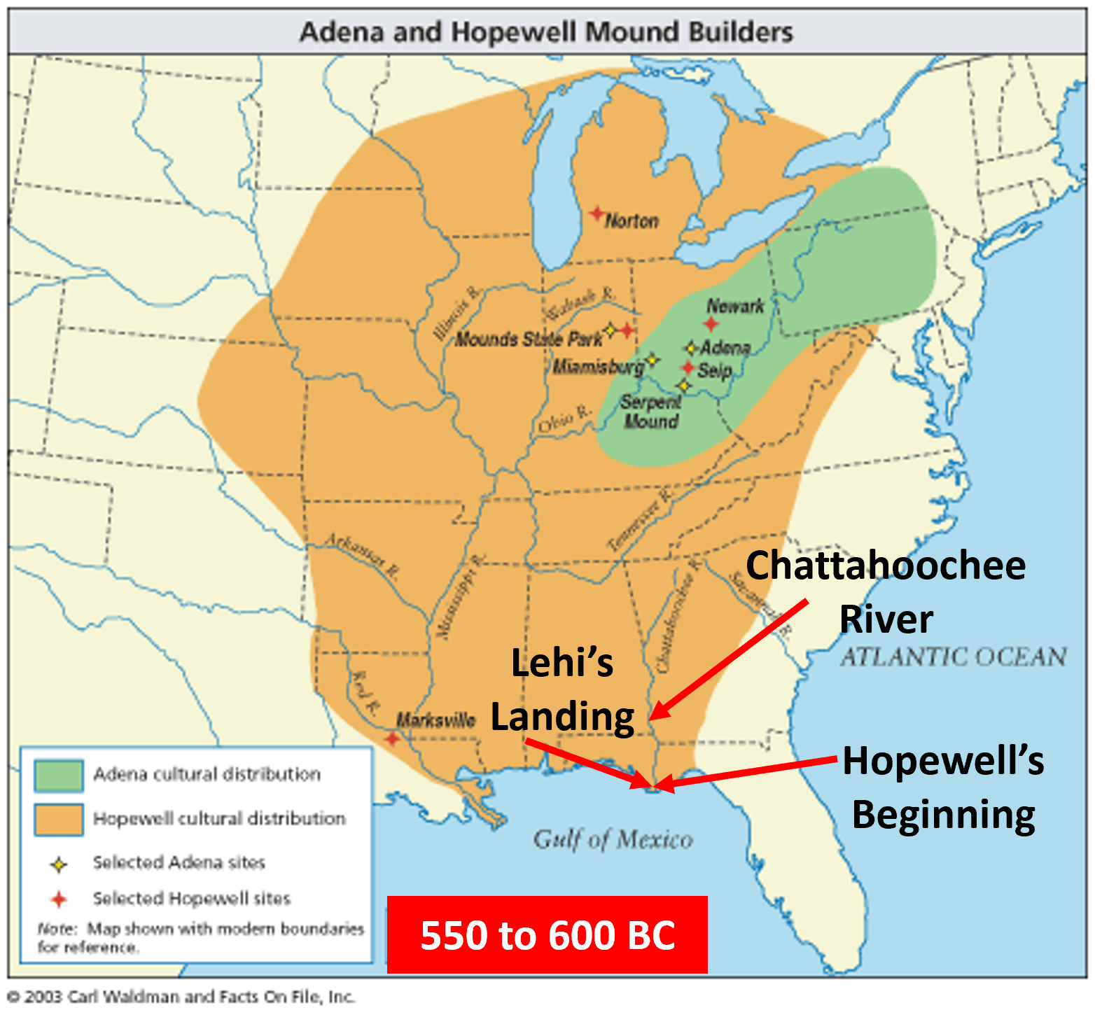
Evidence of a North American Setting in Joseph’s Translation
Jonathan continues, “The “religious seeker” narrative not only accommodates all the available historical evidence, but it also addresses most of the anti-Mormon arguments. For example, when critics complain that the Book of Mormon includes anachronistic 19th century terminology and worldviews, the “religious seeker” narrative responds that as an active translator, Joseph necessarily used his own vocabulary and worldview to render the ancient text into English.” Source:
Think about the words Curelom and Cumom. If a mysterious angel [Jonathan calls it a “mysterious incognito supernatural translator”(MIST)], wrote these words on a simple stone in a hat, why wouldn’t that mysterious angel just tell Joseph the new world name for those animals? Instead Joseph from his own mind and understanding of the words Curelom and Cumom was the best understood English translation for what he saw in the Urim and Thummim. Wouldn’t that mysterious angel also know the names Mammoth and Mastodon? Yes! But Joseph apparently didn’t know those named animals, so he called them what best he understood as he read through the spectacles as, Curelom and Cumom.
In the same way as in the example above, did this mysterious angel know what a Horse and a Tapir were? Yes! Why did Joseph use the word, Horse? He saw it and understood that name in the spectacles. If Joseph understood the name Tapir like in Central America, he would have written the word Tapir, correct? [These are simply fun side notes to my main topic of “Stone Tools Alongside Mastodon Bones in a Florida River”, as it all Just Makes Sense to me]

The Myth Continues
There has been no archaeological evidence in Mesoamerica for Horses, Elephants, Mammoths, or Mastodon’s during the time of the Jaredites and Nephites. But, in North America the evidence is huge. I really don’t understand why the myth in Mesoamerica continues, but it does. See my blog here about horses, and here about Mammoths.
Citing evidence from Joseph Fielding Smith, he has an idea of why the myth continues. “This modernistic theory of necessity, in order to be consistent, must place the waters of Ripliancum and the Hill Cumorah some place within the restricted territory of Central America, notwithstanding the teachings of the Church to the contrary for upwards of 100 years. Because of this theory some members of the Church have become confused and greatly disturbed in their faith in the Book of Mormon. It is for this reason that evidence is here presented to show that it is not only possible that these places could be located as the Church has held during the past century, but that in very deed such is the case… It is known that the Hill Cumorah where the Nephites were destroyed is the hill where the Jaredites were also destroyed. This hill was known to the Jaredites as Ramah. It was approximately near to the waters of Ripliancum, which the Book of Ether says, “by interpretation, is large, or to exceed all…
It must be conceded that this description fits perfectly the land of Cumorah in New York, as it has been known since the visitation of Moroni to the Prophet Joseph Smith, for the hill is in the proximity of the Great Lakes and also in the land of many rivers and fountains. Moreover, the Prophet Joseph Smith himself is on record, definitely declaring the present hill called Cumorah to be the exact hill spoken of in the Book of Mormon. Further, the fact that all of his associates from the beginning down have spoken of it as the identical hill where Mormon and Moroni hid the records, must carry some weight. It is difficult for a reasonable person to believe that such men as Oliver Cowdery. Brigham Young, Parley P. Pratt, Orson Pratt, David Whitmer, and many others, could speak frequently of the Spot where the Prophet Joseph Smith obtained the plates as the Hill Cumorah, and not be corrected by the Prophet, if that were not the fact. That they did speak of this hill in the days of the Prophet in this definite manner is an established record of history.” Doctrines of Salvation Joseph Fielding Smith Chapter 12
Wakulla Springs, Florida
Now I will speak about a most wonderful first magnitude spring, or, Hydrological spring, (called Wakulla Springs), which is a naturally occurring place where water flows from the aquifer (underground) to the surface.” I propose that Lehi was guided to this amazing area by the Lord. It was also a place of some of the most incredible honey in the world, called Tupelo Honey.
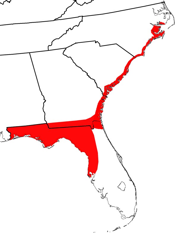
Tupelo Honey vs. Wild Flower Honey
“The thing to note about wild flower honey is it can come from any place in the world; the name simply denotes that the bees took nectar from local flora. On the other hand, tupelo honey can only come from the blossoms of tupelo trees, which grow in specific areas along the Apalachicola River in Florida and Georgia.[The proposed Land of first inheritance]. Tupelo honey also has a higher fructose-to-glucose ratio than other honeys, which means it crystalizes slower [Some have said it rarely ever crystalizes], than wildflower honey and offers the eater less of a sugar crash. Then there’s the taste. Tupelo honey has a distinct buttery flavor laced with notes of cinnamon and fragrant flowers. Wildflower honey can pick up the nuances of whatever blossoms are around, and it’s rarely made from a solo flower.” Source
Wakulla Springs as it empties into the Wakulla River Map below showing the location of
Wakulla Springs is located 14 miles (23 km) south of Tallahassee, Florida and 5 miles (8.0 km) east of Crawfordville in Wakulla County, Florida at the crossroads of State Road 61 and State Road 267. It is protected in the Edward Ball Wakulla Springs State Park.
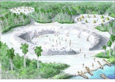
Wakulla cave is a branching flow-dominated cave that has developed in the Floridan Aquifer under the Woodville Karst Plain of north Florida.
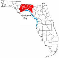
It is classified as a first magnitude spring and a major exposure point for the Floridan Aquifer. The spring forms the Wakulla River which flows 9 miles (14 km) to the southeast where it joins the St. Mark’s River. After a short 5 miles (8.0 km) the St. Mark’s empties into the Gulf of Mexico at Apalachee Bay.
[The Light house at St Marks River is one of the destinations on Rod Meldrum’s Book of Mormon Evidence Tours. Information here: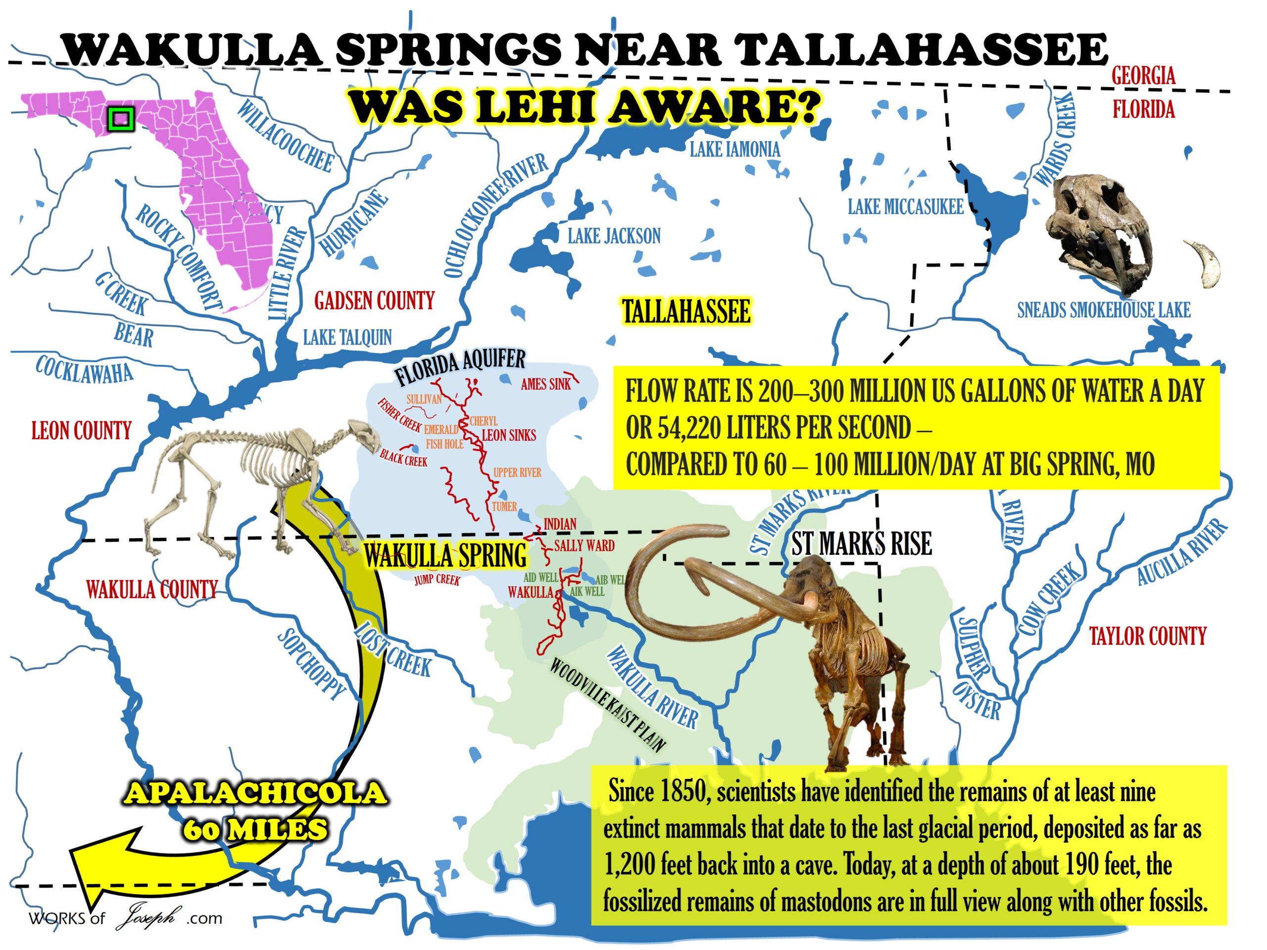
History and discovery
Scientific interest in the spring began in 1850, when Sarah Smith reported seeing the bones of an ancient mastodon on the bottom. Since that time, scientists have identified the remains of at least nine other extinct mammals that date to the last glacial period, deposited as far as 1,200 feet (360 m) back into a cave. Today, at a depth of about 190 feet (58 m), the fossilized remains of mastodons are in full view along with other fossils.
The Florida Geological Survey (FGS) commissioned their first study in August and September 1930 with geologist Herman Gunter.[3] Gunter’s work focused on the recovery of fossils found in the spring basin. He utilized hard hat diving techniques, a dredge, and “long-handled grappling tongs”. A mastodon recovered from their work is now on display at the Museum of Florida History.
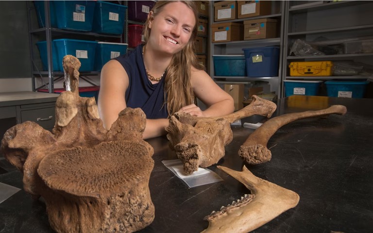
The FGS conducted additional studies at Wakulla Springs in 1955, 1956, and 1962 under the direction of vertebrate paleontologist, Stanley J. Olsen. Olsen’s team of six divers from Florida State University discovered animal fossils deeper within the spring complex where they also found archaeological evidence of early humans, including bone and stone tools. Ultimately, the presumed behavioral association among the recovered cultural and fossil materials could not be demonstrated unequivocally because of the difficulty of establishing and maintaining provenience control in a submerged spring-vent context. (continued)

A major further exploration of Wakulla Springs was conducted in October–December 1987 by an expedition led by Dr. Bill Stone. The expedition team, which also included Sheck Exley and Wesley C. Skiles, penetrated the cave system to a distance of 4,160 feet (1,270 m) from the cave entrance. Skiles filmed the expedition for a National Geographic special. During the expedition Stone’s Cis-Lunar Mk-1 rebreather was demonstrated in a 24-hour dive which used only half of the system’s capacity. In 1998 and 1999, Stone directed an international group of explorers consisting of over 100 volunteers to participate in the Wakulla 2 Project.
Prehistoric Humans
Upper Paleolithic – Paleo-Indians lived at or near the spring over 13,000 years ago [We understand the dating to be in error] and were descendants of people who crossed into North America from eastern Asia during the Pleistocene. The Wakulla Lodge Site is one of several pre-Clovis sites in North Florida. Although modern people think of Florida as a damp/subtropical place, during the first population period, it would have been a very dry and arid climate with a much lower shoreline. This made freshwater locations attractive to megafauna which likely led Paleo-Indians to the site.
Prehistoric Animal Life
American mastodon (Mammut americanum) found at Wakulla.
Giant ground sloth (Eremotherium laurillardi)
Saber-toothed tiger (Smilodon populator) found at Wakulla.
Columbian mammoth (Mammutus columbi)
Ancient bison (Bison antiquus)
Equus (Equus scotti) found near Wakulla.
Short-faced bear (Arctodus simus)
Miocene dugong (Metaxytherium crataegense) found near Wakulla.
American lion (Panthera leo atrox) found in Florida. Source
PRE-CONTACT FLORIDA:
Abstract of Dissertation Presented to the Graduate School of the University of Florida in Partial Fulfillment of the Requirements for the Degree of Doctor of Philosophy
HUMAN BIOLOGICAL VARIATION AND BIOLOGICAL DISTANCE IN PRE-CONTACT FLORIDA: A MORPHOMETRIC EXAMINATION OF BIOLOGICAL AND CULTURAL CONTINUITY AND CHANGE
By Maranda Almy Kles May 2013 Chair: Michael Warren Co-chair: John Krigbaum Major: Anthropology
 The archaeological relationships of cultures have long been analyzed and debated; however, the interpretation of the biological relationship of the associated populations labeled is relatively new. Cranial morphology has been used to understand origins and relationships of races or ancestry groups. More recently these analyses have been applied to archaeological populations. However, this type of bioarcheological approach has been rarely used in the Southeast. The analysis of cranial variation within samples from sites associated with known cultural labels has the potential to provide new insight into the biological relationship or interaction of the individuals buried at these archaeological sites.
This study utilizes 20 craniometric variables from 404 individuals associated with 27 sites across present-day Florida. These sites are associated with a variety of cultural labels and varied geographic and environmental settings. To statistically analyze the craniometric variables, I conducted Principle Component Analyses, Discriminant Function Analyses, and R-matrix Analyses to investigate the patterns of biological 15 variation found within these populations and to determine if those patterns correlate with cultural, temporal, or geographic differences. It was determined that there were at least two migration events into the peninsula after the Paleoindian period. Secondly, patterns were found that suggest parent-descendant group relationships for many of the Archaic populations assessed. Additionally, there was a biological distinction between the populations associated with the “classic” Weeden Island and Manasota cultures. Lastly, it appears that the Weeden Island and Mississippian cultures had culturally recognized barriers to biological interaction that resulted in greater genetic variation within these populations.
These findings indicate that there are discernible patterns to human biological variation found within the pre-Contact populations of Florida and that this variation often corresponds to the cultural variation interpreted from the archaeological record. However, a few notable exceptions in the Archaic and Weeden Island populations show that additional work is needed both on the biological and archaeological fronts. This research has broad implications with regard to assigning unprovenienced skeletal remains to cultures or sites, which contributes to the analysis of cultural affiliation relevant to Native American Graves Protection and Repatriation Act and fosters constructive dialogue between all interested parties.” Maranda Almy Kles
Rising seas threaten hundreds of Native American heritage sites along Florida’s Gulf Coast
Native North Americans first arrived in Florida approximately 14,550 years ago. Evidence for these stone-tool-wielding, megafauna-hunting peoples can be found at the bottom of numerous limestone freshwater sinkholes in Florida’s Panhandle and along the ancient shoreline of the Gulf of Mexico.
Specialized archaeologists using scuba gear, remote sensing equipment or submersibles can study underwater sites if they are not deeply buried or destroyed by erosion. This is important because Florida’s archaeological resources face significant threats due to sea level rise driven by climate change. According to a new U.N. report, global sea levels could increase by over 3 feet by the year 2100.
Archaeological sites contain evidence of what people ate in the past, what kinds of houses they built, how they buried their dead and what they did to memorialize stories, leadership and community. These places literally embody human lives, and are the only records we have of prehistoric indigenous peoples of the New World.
Between the years 1500 and 1850, 2.5 million Europeans migrated to the New World. As a consequence of their arrival, 50 million indigenous people died from disease, massacres and slavery…
Valuable and Vulnerable
At present, 1,539 archaeological sites are located at or below sea level in Florida. By A.D. 2100 up to 6,820 will become submerged by sea level rise.
Florida’s Big Bend region – the eastern half of the Panhandle – contains 541 Native American archaeological sites, found from the coast to inland hills and river valleys. They include earthen and shell mounds and shell middens, or refuse heaps. These sites belong to Deptford, Swift Creek, Weeden Island or Fort Walton and Apalachee cultures, and represent a time period of over 2,000 years of occupation, from 500 B.C. to 1540 A.D.
Archaeological sites belonging to these cultures in the Gulf of Mexico region represent a continuation of earlier lifeways dating as far back as 7,000 years ago. But they also mark shifts in ceramic and stone toolmaking technology, and significant changes in ceremonies associated with monument construction and burial of the dead.
Notable sites in this region include Mound Field, Bird Hammock and Garden Patch – places where hunter-fisher-gatherers built monuments, traded for goods and practiced crafts such as basketry and bead and pottery production.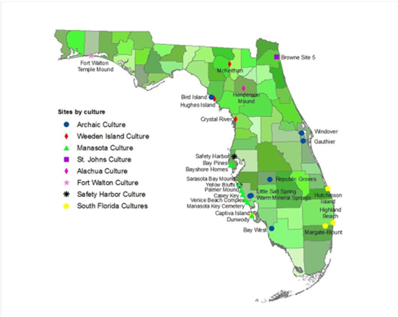
The Garden Patch site, a barely investigated Middle Woodland shell midden and six-mound complex, is one of Florida’s innumerable cultural resources at risk. With roughly 5 to 6 feet of additional sea level rise, most low-lying areas at the site will be flooded, and saltwater will kill grasses and trees. With no tree cover or vegetation, the site’s mounds, middens and mortuary remains will erode away and be permanently destroyed.
There are cost-effective ways to stabilize the site and make it more resilient to climate change. They include planting salt-tolerant grasses and shrubs, such as spartina and saline-adapted mangroves, and building sea walls and levees to redirect water. However, studies show that hard systems like this are not always effective and can have negative environmental effects on surrounding areas.
An even more effective response is raising public awareness of America’s Native and Indigenous heritage, and encouraging study of these sites while they are still above water.
Saving Stories by Saving Places
Other parts of the Gulf coast, such as the Mississippi River Delta and coastal Louisiana, are comprised mainly of low-lying marshes that are extremely vulnerable to sea level rise. In contrast, Big Bend interior cities like Tallahassee will be relatively well protected by geographic features that prevent seawater from penetrating far inland.
Except for universities, hospitals and government in Leon County and Tallahassee, the main industries in the coastal Big Bend region are fishing, farming and tourism, and the population of the entire area is just 500,000. Relatively few people in this part of Florida will be affected by rising seas compared to large, low-lying cities like Tampa, Miami and Jacksonville, with a collective population of 9.6 million people.
However, infrastructure along the coast will be significantly affected. For example, St. George Island State Park, which is on a 28-mile barrier island, incurred over US$5 million in damage from Hurricane Michael in October 2018, and the entire island will be inundated with as little as one meter, or about 3 feet, of sea level rise.
American history is Native American, African American, Latinx, Asian and European. Our cumulative story begins 15,000 years ago and ends when we decide. In our view, Americans and scholars have an obligation to try to save our collective histories.
By advocating for the study of the past, we hope to encourage documentation of endangered landscapes, collaborative data recording, multi-agency partnerships and acknowledgment that the U.S. is going to lose sites that are parts of its heritage. Rather than focusing on preserving singular parts of America’s past, like Jamestown, Virginia, the first permanent English settlement in North America – which is also in a low-lying and threatened environment – we want to see lesser-known features of America’s past documented and saved as well.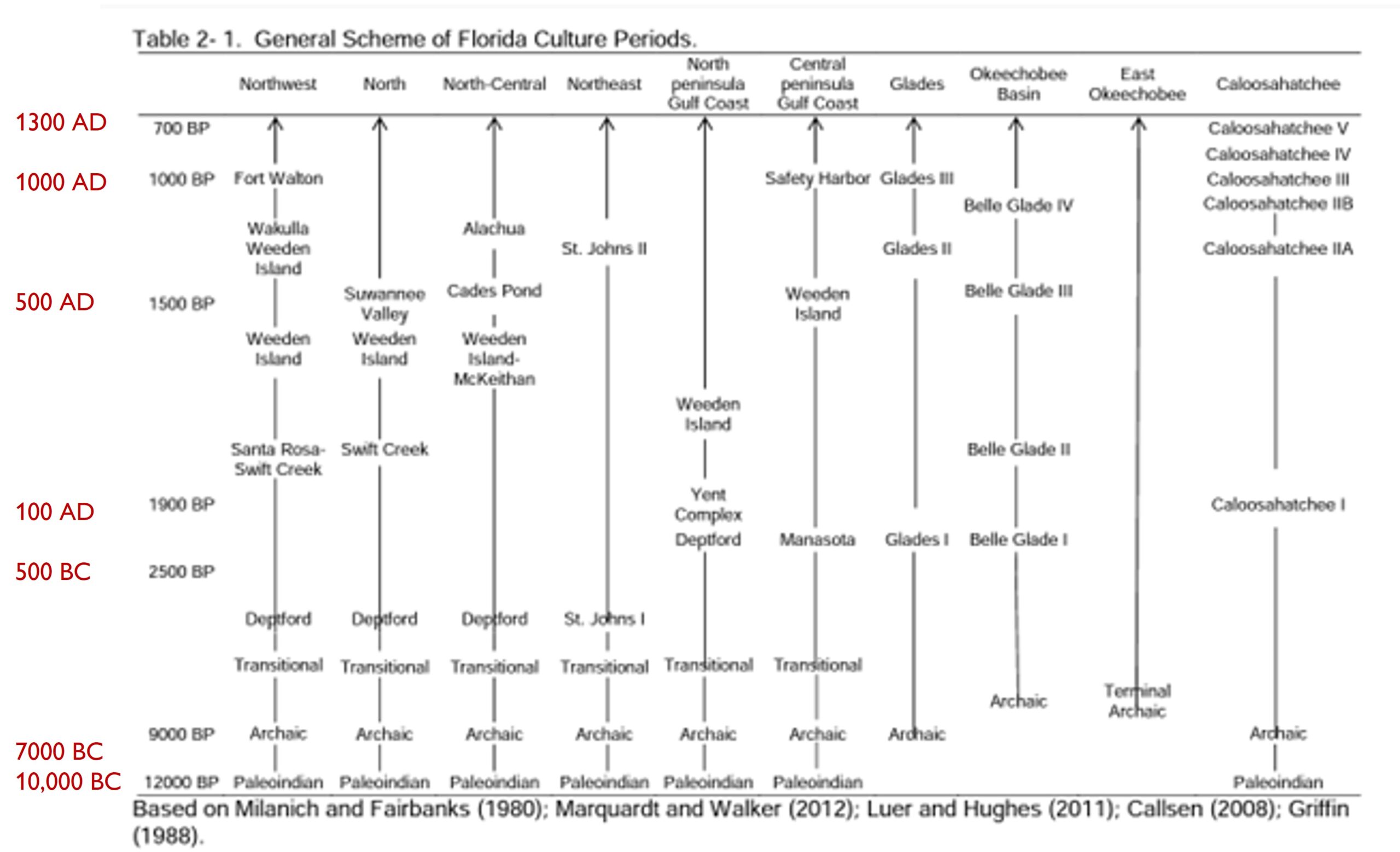
As we see it, Americans’ collective identities are rooted in a shared past and in physical landscapes and places. That makes saving these places important. The first step is talking about them. The next step begins when scholars and the public come together to learn about the past and advocate for preserving it…
Woodland Period
The Woodland period began ca. 2500 BP [500 BC] and is marked by a relatively stable environment with sea levels near modern levels and a warm humid climate similar to the present day (Schuldenrein 1996; Watts et al. 1996). Interestingly, there is an apparent decrease in the occurrence of long-distance, exotic trade goods and an increase in local or semi-local materials and goods, which occurs coevally with a greater regionalization of pottery styles and techniques (Anderson and Mainfort 2002a). Archaeologists have long held that regionalized pottery can be used as a marker for distinct archaeological cultures (Anderson and Mainfort 2002a; Willey 1949). Often similarities in the pottery styles or assemblages are used to link distant groups to each other, while other times geography is used to divide somewhat similar assemblages into distinct groups (Anderson and Mainfort 2002a).
The Florida Woodland period is marked by the appearance of several distinct cultures, including Deptford in the northern half of the peninsula and Manasota or early Glades in the southern half. These cultures share similar settlement and subsistence patterns, a coastal orientation, and a band level society with small communities that may have traveled inland seasonally to harvest non-coastal resources (Milanich 1994; Stephenson et al. 2002). The observed regionalization of pottery is associated with a rise in ceremonialism, particularly evident in the development of the Weeden Island 32 Complex. Anderson and Mainfort (2002a) suggest that this may have been due to a cultural power shift from the Midwest to the Southeast, particularly in the Lower Mississippi and Gulf Coast areas, where the Coles Creek and Weeden Island cultures are present. This has led archaeologists to speculate that there was interaction between the areas (Milanich 2002; Stephenson et al. 2002), but whether it was an exchange of ideology or a movement of people or both is not clearly understood.
Central Florida Mounds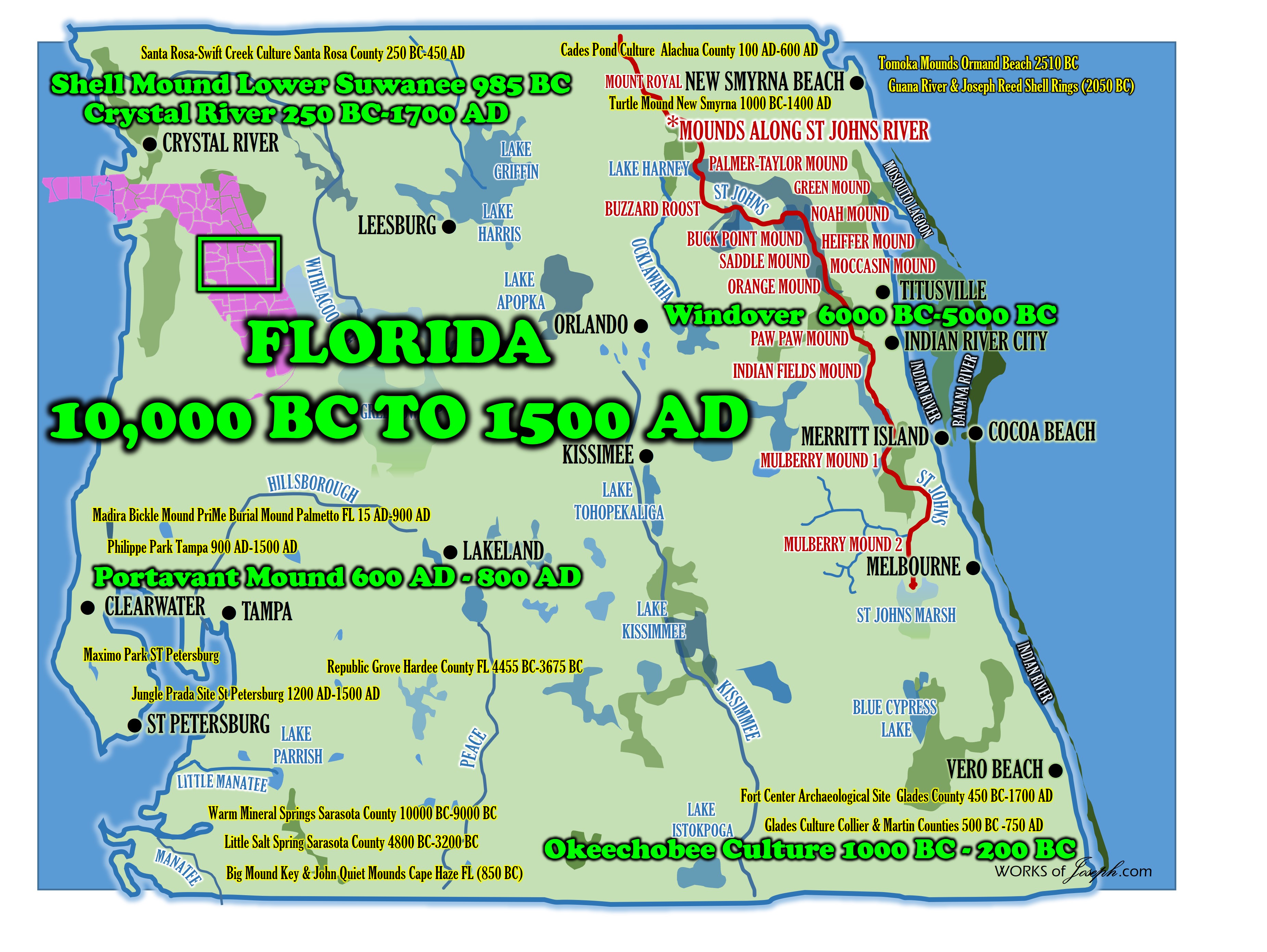
The Weeden Island Complex spanned most of the central and northern portions of Florida, as well as portions of southern Georgia and Alabama. This broad geographic range suggests there was an extensive interaction-sphere involving the exchange of objects and ideology (Anderson and Mainfort 2002a). The cultures associated with the Weeden Island Complex are marked by a distinct sacred/secular dichotomy found in the pottery associated with the village and burial mound sites (Milanich 2002; Cordell in Milanich et al. 1997). The cultures associated with the Weeden Island Complex are also marked by the construction of burial mounds that provide evidence of elaborate ceremonial practices associated with single or multiple burial events. These burial events involved the removal of numerous individuals from charnel houses or similar storage/processing areas and placing them on prepared surfaces for mass burial with sacred pottery or other objects of importance (Milanich 1994; 2002; Willey 1949). Some sites apparently developed into significant ceremonial centers with one or more large mounds indicating elaborate and repeated burial events. These sites appear to correspond with trade-hubs making them key in a widespread ceremonial and exchange network (Anderson and Mainfort 2002a). Mounds, such as McKeithan, a large mound site in North Central Florida, were most likely constructed in or near the village of a 33 lineage that was in power. As resources in an area were exhausted or there were shifts in trade patterns, power transferred to a new lineage and mound construction began in a new area (Milanich 1994; 2002).
Another significant feature of Weeden Island Complex is that despite apparently sharing various aspects of sociopolitical structure and religion, particularly the sacred/secular dichotomy, each culture developed distinct environmental adaptations. These adaptations are found within specific physiographic parameters, which then help to define the regional complexes, based on differences in apparent settlement and economic patterns (Milanich 2002). The thorough command of the local environment by these peoples suggests sedentism or at least a localized mobility allowing for a specialized tool kit and subsistence strategy.
In the Late Woodland of Florida, there is a shift to a hierarchical social system, such as that seen in the Wakulla and Suwannee culture, and in some areas this corresponds to an increased reliance on maize agriculture (Anderson and Mainfort 2002a). At the end of the Woodland period much of the Southeast transitions into the Mississippian period, with its ranked society and associated iconography, as seen in the Fort Walton and Safety Harbor cultures. However, many of the cultures in the peninsula continue in their late Woodland form through Contact. A more detailed discussion of the Woodland period in Florida follows and is presented by geographical region in order to follow the cultural developments and transitions of each culture.
North Florida
The Deptford culture, which appears in the Early Woodland, is found in the southern Southeast and is divided into three regional variants: Gulf Coast, Atlantic 34 Coast, and Coastal Plain Interior-Riverine (Milanich 1994; Stephenson et al. 2002). Two of the three variations appear in Florida, the Gulf Coast and Atlantic Coast varieties. Although they share similar subsistence and settlement patterns, these cultures differ in subsequent sequences allowing them to be considered separate taxonomically (Stephenson et al. 2002).
The Gulf Coast Deptford culture is marked by primarily coastal habitation sites with interior special use sites [2500 BP/500 BC] (Jefferies 2004; Milanich 1994). The pottery is characterized by simple stamp, linear check stamp, or check stamp pottery with a sand or grit temper (Milanich 1994; Willey 1949)
In the northern Gulf Coast region, late Gulf Coast Deptford develops into the Yent and Green Point complexes (Milanich 1994), which exhibit an early form of the sacred/secular dichotomy that is evident in the later Weeden Island Complex (Stephenson et al. 2002). The Crystal River site complex, which is one of the most studied Yent site complexes, appears to begin its use in the Early Woodland (Milanich 1994; Stephenson et al. 2002). Crystal River eventually becomes a major ceremonial center within the Weeden Island Complex and may have been used into the Safety Harbor period, although this late use/habitation is still speculative (Pluckhahn et al. 2010).
Analise Hollingshead, a former graduate student at Florida State University, contributed to this article.